Footpath Route Planner App Reviews
Footpath Route Planner App Description & Overview
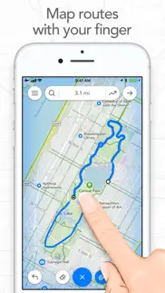
What is footpath route planner app? Map routes with your finger and Footpath will snap to roads and trails. Measure distances and elevations in seconds, then navigate along with turn-by-turn directions.
Footpath is the ultimate companion for planning and navigating custom routes.
Join millions of adventurers and plan out your perfect route.
SNAP TO MAP
Quickly measure distances by tracing a map with your finger or Apple Pencil. Footpath will snap to roads and trails on the map.
MEASURE DISTANCE AND ELEVATION
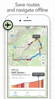
Know exactly how far and how high you'll travel with elevation profiles. Plan routes that match your goals.
SAVE ROUTES FOR LATER
Plan out your week or trip. Keep up to 5 routes on hand for reference, or save unlimited routes with Footpath Elite.
SHARE ROUTES
Send your routes to friends or workout partners to open on their device.
Footpath is designed to work for pretty much any activity or adventure, in any country:
• Running
• Cycling and mountain biking
• Hiking and mountaineering
• Walking
• Motorcycling and driving
• Backcountry skiing
• Kayaking and standup paddleboarding
• Sailing
• And many more!
FOOTPATH ELITE
Ready to go the extra mile? Upgrading to Footpath Elite unlocks the following powerful features:
TURN-BY-TURN NAVIGATION
- Footpath will tell you when to turn with turn-by-turn audio cues on your iPhone and Apple Watch
- Save your route and cues in advance for voice guidance that works completely offline
- Double tap your AirPods or use the playback controls button on your headphones to replay your next cue
PREMIUM OFFLINE MAPS
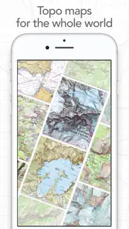
- 3D and topographic maps including Footpath Outdoors (Worldwide), USGS Topo Maps (U.S. and Canada), OpenCycleMap (Worldwide), and many more
- Cycling lanes, avalanche slope shading, and elevation contour lines
- Download maps for use offline
- Save places as favorites to customize your maps
ORGANIZE
- Create and edit unlimited saved routes
- Duplicate, merge, and split routes
- Organize and sort routes into custom lists
ANALYZE
- Record GPS tracks of your activities
- Use HealthKit display and log extra health and fitness metrics such as heart rate during a GPS activity
- View a calendar log and weekly summary of your activities
- Analyze splits, speed, elevation, and heart rate
- View a heatmap of your speed during your activity
EXPORT
- GPX import and export
- TCX and FIT course export for turn-by-turn navigation on Garmin and Wahoo GPS devices
- Export cue sheets to a spreadsheet app for customization and printing
- Export your routes and workouts to Apple Health
You can purchase a Footpath Elite monthly or yearly subscription through your iTunes account. Your subscription will automatically renew unless cancelled at least 24 hours before the end of the current period. Auto-renew can be turned off anytime by going to the Manage Subscriptions page in settings after purchase, and your features will remain active until the end of the subscription period. Your account will be charged for renewal within 24-hours prior to the end of the current period at the same cost as your original purchase.
TIPS FOR MAPPING ROUTES
• For longer routes, try zooming in and mapping your route in multiple segments.
• Tap and hold the map to quickly route between waypoints and POIs.
• Did Footpath snap to the wrong roads? Trace over the incorrect segment to edit, or use the eraser tool.
• Turn off snap to roads (magnet icon) and zoom in to manually trace the map. (Try switching to a satellite layer).
• Displaying maps and continuously running GPS in the background can dramatically decrease battery life. Navigate without maps or with the screen off for all day battery life.
CONTACT US
We've got a lot planned for Footpath. If you have any suggestions or feedback, or if you run into any issues, please contact us at [email protected]
Terms of Service: https://footpathapp.com/terms
Privacy Policy: https://footpathapp.com/privacy
😍 Do you love Footpath Route Planner app? Please share your friends!



Please wait! Footpath Route Planner app comments loading...
Footpath Route Planner 4.10.9 Tips, Tricks, Cheats and Rules
What do you think of the Footpath Route Planner app? Can you share your complaints, experiences, or thoughts about the application with Half Mile Labs LLC and other users?



Footpath Route Planner 4.10.9 Apps Screenshots & Images
Footpath Route Planner iphone, ipad, apple watch and apple tv screenshot images, pictures.
| Language | English |
| Price | Free |
| Adult Rating | 4+ years and older |
| Current Version | 4.10.9 |
| Play Store | com.ericrwolfe.Footpath |
| Compatibility | iOS 17.0 or later |
Footpath Route Planner (Versiyon 4.10.9) Install & Download
The application Footpath Route Planner was published in the category Navigation on 07 May 2013, Tuesday and was developed by Half Mile Labs LLC [Developer ID: 634845721]. This program file size is 115.57 MB. This app has been rated by 21,445 users and has a rating of 4.7 out of 5. Footpath Route Planner - Navigation app posted on 09 April 2026, Thursday current version is 4.10.9 and works well on iOS 17.0 and higher versions. Google Play ID: com.ericrwolfe.Footpath. Languages supported by the app:
DA NL EN FR DE IT JA PT ZH ES SV ZH Download & Install Now!| App Name | Score | Comments | Price |
- Bug fixes Leave us an App Store review if you're enjoying Footpath, or feel free to contact us at [email protected] with any problems or suggestions.
| App Name | Released |
| Divvy Bikes | 16 May 2018 |
| Neshan Map | 04 May 2023 |
| Premium Parking | 22 October 2013 |
| Electrify America | 03 June 2019 |
| DC Metro and Bus | 19 November 2012 |
Find on this site the customer service details of Footpath Route Planner. Besides contact details, the page also offers a brief overview of the digital toy company.
| App Name | Released |
| AyeTides | 06 February 2019 |
| Aprs.fi | 02 December 2015 |
| ADOT 511 Traffic Cameras | 31 March 2023 |
| Light Pollution Map | 20 September 2020 |
| Theodolite | 30 November 2009 |
Discover how specific cryptocurrencies work — and get a bit of each crypto to try out for yourself. Coinbase is the easiest place to buy and sell cryptocurrency. Sign up and get started today.
| App Name | Released |
| Netflix | 01 April 2010 |
| SHEIN - Online Fashion | 19 May 2014 |
| YouTube TV | 05 April 2017 |
| 06 October 2010 | |
| 12 February 2019 |
Install the Giftmio extension for smart shopping. Get notified about cashback opportunities, activate cashback in one click, and save money on purchases.
| App Name | Released |
| Geometry Dash | 13 August 2013 |
| Plague Inc. | 25 May 2012 |
| AnkiMobile Flashcards | 26 May 2010 |
| Procreate Pocket | 17 December 2014 |
| Shotgun King | 24 February 2026 |
Each capsule is packed with pure, high-potency nootropic nutrients. No pointless additives. Just 100% natural brainpower. Third-party tested and validated by the Clean Label Project.
Adsterra is the most preferred ad network for those looking for an alternative to AdSense. Adsterra is the ideal choice for new sites with low daily traffic. In order to advertise on the site in Adsterra, like other ad networks, a certain traffic limit, domain age, etc. is required. There are no strict rules.
Keep personal info private, avoid scams, and protect yourself online with AI-powered technology.
Footpath Route Planner Comments & Reviews 2026
Incredibly useful app with a few minor UX flaws. This app has been incredibly useful as I train for longer distances and need to plan those runs for specific lengths. Especially valuable when you’re trying to get a certain distance while traveling somewhere you’re not used to. It’s so well-designed for that purpose that I’m surprised when little user experience quirks pop up: for example, while it’s very clear how to start creating a route, saving it can only be done if you intuit that the icon usually meaning “share” or “export” (a box in the upper right-hand corner of the route-editing screen) is actually what you tap to do that. I have other small kvetches but they shouldn’t obscure the fact that this is a great tool that I highly recommend.
Excellent for creating routes!. This is the only app I have found that allows you to create routes by touching a trail. You don't have to touch every spot, just every half mile or so and the route "snaps" to the trail. When done it displays distance and an elevation profile. A number of different background maps are available, including USGS Topo, satellite maps, etc. Access to the maps are via WIFI or cellular data. However the saved routes can be exported to other map apps that can download maps for off-line use.
Couldn't bring up maps on my final ascent. After transitioning to booting on my ski trip yesterday, the action button would no longer display the map on my watch. Either the Footpath app crashed or it auto paused (perhaps since booting up a 45 degree plus slope would appear as no movement?). After a few desperate attempts to get mapping working I realized that somehow Footpath got paused, but even after unpausing I couldn't get the action button to bring up maps. Luckily my ski partners Garmin Fenix guided us correctly between perilous cliff bands on our descent. Unfortunately, these Apple watch "Ultras" don't seem to live up to their name. I have lost trust in these devices being able to safely guide me in the backcountry. Luckily I wasn't on a remote peak, only 4 or so miles from our car, and my partner's watch saved us from accident turning down onto a cliff.
Work at this; give yourself some time to focus.. I use this infrequently, and therefore, it requires some planning ahead of time… those with whom I bike don’t want to wait for me to waste their time with my OCD influenced methods of planning. That aside, I really enjoy the planning effort, because, especially for those places in which I am unfamiliar or for example, vacation traveling for the first time in our NewMar 4369, I can enjoy the ride while riding, rather than having to pay close attention to where I am in order to avoid getting lost, or having to backtrack over territory that is not enjoyable to me. The information I obtain and/or learn, is fundamentally helpful in the sense that I retain a lot more about the environment and can focus on the pleasureable visual elements. For example, I love trees and can photo trees while riding and then associate the photos with the specific location on the route. I highly recommend recommend this app.
Loving this app!!!. The only reason I didn’t give a 5 star, could be my own fault. Ending a run on my Apple Watch is always confusing. I’m never sure how to end it, and once I do, I’m not sure how I got there. Having said that, I love this app. I love creating my routes, I love the colors that show me the hard hills, I love being able to transfer my route to my watch, I love that most of the time the turn-by-turn instructions come through my Shokz (occasionally if my STRAVA- which never comes through my Shokz- announces my mileage in close time to a turn, footpath will announce through my watch, but then reset and come back through my Shokz). I’ll be going on vacation and I’m using footpath to plan my runs in another state. Soooo worth it! Thank you!
This app is incredible. I use Footpath multiple times a week and couldn’t be more impressed. Most of my runs are on trails and my Garmin isn’t even close to as accurate as this app. The trail maps are remarkably extensive and I also use it find trails which don’t appear on Garmin, Google, or Strava. Most of my experience with this app is in Portland, Oregon but I use it when I travel and it’s worked great everywhere I’ve been. Overall the app is intuitive and easy to use. The drawing feature is super useful with snap to map on or off and everything loads really quickly. The maps are beautiful and the ability to store lots of routes made the elite version worth it for me. I’ll be using this app for a long time.
Anytime, anywhere, this app is the bomb!. I absolutely love this app. It’s a great planning tool before going running, backing, walking, etc. I’ve used it while backpacking in wilderness areas as my map allowing me to stay on the trails that are hard see or may be lightly used. Once when trekking down a creek, I used the app to find the nearest trail. I also use it plan my running routes. When planning long runs and need to plan a route of 20+ miles, this is my tool to determine where I go. Just using my finger, I can plan a great route, save and even check upcoming status. The snap to road and trails is one of the best features. I have not found any other app that provides the ability to plan and execute type 2 fun and exercise!
Great at what it does. This app is very good at what it is intended to do (or at least what I intend to use it for). I just wish it had better integration with third party apps such as Strava. I mapped out a backcountry XC ski route in an area without signal and service with the intention of using offline maps and cue. It was very easy and intuitive to draw the route in my iPhone. transferring to my Apple Watch Ultra 2 for the offline map and cues was a breeze. It worked very accurately starting in an area miles away from cell service. I was able to run Strava in the background with a couple of swiping press of the buttons. This third party app takes advantage of what Apple has set up for developers to use to make the Ultra 2 compete with Garmin Epic and Fénix.
Excellent for hikes/walks and w/ watch. I tested this app on a holiday in the Cotswolds alongside another map/tracking software that used pdf topo maps I created from other route data sources and open source GIS desktop software (yes, I am a geospatial nerd). The convenience of the Apple Watch integration and the additional features, like elevation profiles, made this app my primary tool for planning and tracking our walks by the end of the holiday. I went ahead and subscribed to the annual plan because this app earned it, and I’ve been using it for hikes closer to home in the Sierra Nevada mountains more recently. The route data sources have been excellent and reliable, and this is a new favorite app for me.
It’s a breeze. are usually don’t write reviews, but this app deserves it. The user in your face is clean, intuitive, and full of features to boot. Creating routes on mobile or desktop is simple and painless. I especially like the elevation map features. Sharing maps is another win. You can share your maps by link and others can view the map on mobile in a four featured web UI without downloading the app. Great work!
Totally worth it—make sure you download offline maps. I do a lot of trail running but I’m cheap so I was wary to pay for this, but it’s worth it. Overall it’s a great app for planning ad hoc routes and getting turn by turn in your headphones. I’m away from home for a few months so training in unfamiliar territory and the app has been indispensable. I tap out a route to get the mileage right and manage elevation profile ahead of time, save it, and download the offline map and run with the directions in my headphones the next day. I love the ability to edit routes, upload maps from other platforms, etc. the turn by turn is 95% good. The warnings when getting off route are timely, but sometimes the stated direction for recovering seems unreliable—better to just open the map view if you have a shadow of doubt about getting back on the route. I have noticed distance discrepancy with this app vs AllTrails vs Apple Fitness when I’m on routes that have a lot of elevation changes. I often run all three apps out of curiosity. In one case AllTrails and Footpath estimates differed by more than 0.6 mi on a 10 mile trail run—Footpath usually seems to be the shorter estimate when I’ve noticed it.
Finally, something that works on Apple Watch. I’m traveling around South America and it’s an absolute pain to keep digging out my phone when I need left or right directions. Apple Maps isn’t supported here, and Google Maps just doesn’t want to work. Even if it did, Google Maps just gives a list of turn by turn directions. No map overlay. Footpath to the rescue. Sure, it’s a premium feature, but it’s legitimately the only thing I can find that just lets me send a route to my watch and make sure I’m not going off course.
Great for creating and exploring routes. Disclaimer: I went ahead and paid for the full package so this is an evaluation of that feature set. This is an outstanding mapping ap. I use it to create and save routes and purchased it specifically for that feature set. Unlike traditional mapping aps that will create a route for you but balk when you want to create an alternative, Footpath shines when you want to create and save your own routes. And it works great with my phone. The tools are easy to use and the range of mapping options is impressive. Select your mode of travel (car, bike or walk) then choose which map you want. It's easy to switch maps and I routinely switch to the USGS topo maps. The draw feature works well and the only time I've had problems were when I forgot to switch modes like the time I was trying to get a car map but was in bike mode. Footpath wouldn't let me ride my bike on the Interstate. Or when a particular map didn't recognize a tunnel. Trying to chart a ride around Tahoe required switching from the Auto map to the USGS topo map to go through the tunnel. The elevation feature works very well. Scrub your finger along the elevation chart and a dot on your route shows where that elevation change is on the route with each mile or km marked along the path. Sending a quick map of a proposed route to a friend is easy and I've used this feature repeatedly to help plan bike routes for rides with friends. The full package allows me to save routes and recall them at will. I'm a map geek and this my favorite mapping ap for creating routes hands down.
Works well for me. I don’t currently have an iPhone, Apple Watch or Fitbit that could map my hiking and running. Plus I don’t always want my location services on. Using your finger or a stylus, you use this to map out distances and routes for hikes and running/walking. I travel a lot and get out and explore whenever I can and I use this app often. Overall it seems to do a good job of finding/tracking the trails and roads that I use. It also gives you elevation gain, which is pretty helpful, especially if I’m hiking in the foothills or canyons.
UPDATED: All routes NOT lost. I originally thought all routes were lost after this update. They were not lost! The routes were located in a list named “Other.” This may have occurred when I transferred everything to a new iPad. In any event, this is a great app. I use it mostly to track where I’ve been rather than where I’m going, but I love it! Original review: Just updated the app and lost ALL of my routes. Unbelievable. Use with caution and don’t trust it with anything you care about.
Excellent for unmarked routes. I use it primarily for MTB off trails. Ride once, import GPX from recorded bike run in Apple Watch, and then add my own waypoints so I know where to turn next time. Eyes on the single track, let the watch tell me where to go! Also switching to the map on the watch is great. Post review of effort on the iPhone is great. I’ve also used this on proper trails. Fantastic overall, great developer support - I ran into a snap that was fixed. Highly recommend to anyone for hiking or biking!
Best (of many) I’ve used. I’ve been having too much fun drawing gravel bike routes to explore (and then riding them) . The drawing function - on an iPad - is excellent, and the app is really well designed (good set of features) and well implemented (haven’t hit a bug yet). It’s not so useful unless you subscribe to store maps, but the annual cost is entirely reasonable. And they don’t ensure you into some social media/advertising scheme (which I hate) as most apps do. prefect app for road, gravel, mountain bike route planning
Almost great, but falls for a paid app. There are features that could be added to make this a great app. But i rather make my own. Iphone 11, watch 6. I mostly use my watch. Here are some things are could be fixed. Gps isnt great. Not everyone has the ultra watch (gps). When you run, you arms are on the side. However the map still points as if your holding it as your holding straight forward. Thats lame awhile running. I also think overview and splits can be more catered to professionals athletes. Meaning it could use more features that can do real time comments adding. The editing feature isnt as good, it often gets confused in trail runs or messy roads. If you memorize the routes, this app is useless to me. Because apple health app is good enough.
Could be good, but not for my needs. I feel bad rating this too low because I did not use it for very long. However, that is because I started to get genuinely upset with it. It seems that it would be great for legitimate trails, city streets, etc. However, I had great difficulty getting it to stick to actual suburb roads. At one point it decided I should take a nice detour and bike through the pond. When drawing a simple path with a stylus, it thought it would be fun to throw in a few circles. Additionally, it did not give me sufficient editing abilities. On one trip I tried to map, it had a random straight line going through a woods. I attempted to erase it so I could shift it over, but it just kept reappearing in a different, equally incorrect location. It also completely ignores a popular footpath. The “snap to map” is somewhat a useful, and certainly an innovative feature. It just needs some love. I could see this working on longer trips that need less accuracy, but for my suburban 10 mile excursions it brought nothing but anger. For now, I’m going to stick to drawing vauge lines on a map, and finding out the mileage later. TLDR: I can see it’s applications and situations it could be good in. It just is not at all conducive to my biking or running excursions.
En Route to a Better FootPath. I am a pre-diabetic middle aged male who needs to map out routes for safety and distance. I enjoy the Elevation change feature, and the variable map overlays DO help. This app has many great features! One feature that I think is missing is a flip route feature. Sometimes I want to change my perspective as I walk. Just one idea. I have seen the Out & Back feature added recently( or I JUST noticed it). And have used that successfully. I also enjoy the send to watch feature for my Cellular & GPS enabled series 5. Rarely has the voiceover feature actually worked as I listen to podcasts or audio books while I’m out. I like the haptic feedback at the mile markers very much. I just hope there’s a way to not use up so much battery on my AW5. Another small issue that I’ve had happen is after I sent the route to my watch it appears there’s a second or 3rd instance on the cue. I would like a single reasonable “ONE time” fee but I suppose Developers need a continuing income stream to continue developing and improving the app. So keep working at making it better and worth the annual price and I’ll keep coming back. Overall a 4⭐️ out of 5.
Great idea, hard interface. I really really want to love this app. It has so much potential. But, honestly, the route scripting in urban environments is poor. It doesn’t adjust easily. It assumes you want to do out and back or other options and makes them hard to correct. It will not allow you to draw paths where it doesn’t know they exist. So, for example, there is a well known path through a public right of way in my neighborhood; because the app doesn’t know about it, it wants to add an additional two miles to my route. Why is it so hard to just have a simple routing app that calculates mileage?!? Why can’t an app just trust that I know what I’m routing when I want to tell it, yes, I can go that way? So much potential, but the bells and whistles defeat the basic purpose of the app.
Best app for Apple Watch Ultra. The Apple Watch by itself is terrible because Apple software is very basic. Supposedly it’s going to improve with watchOS 17. We shall see? but with third-party apps it rivals any other outdoor watch on the market for tracking and mapping. Still doesn’t have the best battery compared to Garman, which I have used also. But good enough for me. I’ve tried several third-party apps Gaia and all trails, and this app is easier and faster to use than any other app.
Great tool. This is a great tool. It records routes and rates. It let’s the user export routes that can be shared or imported into another app or device. In theory the reverse is possible, but I haven’t done that. It’s not Facebook for runners. You can share your workout, but that seems secondary. Primarily it helps you plan and record activities. How it does that is it lets me draw with my finger on a map to figure out how far I am going and elevation changes on the route. I know if I’ve increased the distance enough or too much before I leave the house. I know if there is a big hill or valley on the route. The planning done or just out the door and start going, it will record the activity and tell me how I did. What do you want?
Stellar. I've been using this app for a few years now, and it's been consistently improving. When I started using it, it was a good app, now it's great. Planning to run specific distances is challenging. Unless you're ok with doing out & backs for the rest of your life, you're going to have to start making some loops, and that's where this really shines. The capability of _quickly_ creating routes to export as GPX Tracks that can be uploaded to your favorite running watch alone makes this app indespensible, but the ease of creating the routes is what really makes this app special. The technology honestly blows my mind. Making new and interesting routes has become a kind of mindless past-time which leads to some pretty interesting rewards while running. I'm pretty busy, so writing reviews doesn't normally make it into the priority list. This app is so useful, helpful, and simple to use that I felt compelled to say something about it. Get it. You'll be glad you did.
It's... perfect. I've been using this app for 3 years, and it keeps getting better. The baseline functionality of route planning, turn-by-turn, map views, performance, etc was already excellent. But the developer kept going. Each release has improved the "nice-to-have" features like upcoming turn notifications and even the angle of arrows in the quick-glance wayfinding view that have made the app *exquisite* to use. As a trail runner, I couldn't be happier with Footpath and will absolutely keep using this app over mainstream alternatives. It's really a joy to use.
Free version of app is horrible!. I got the free version of this app to create routes for cycling with my bike club/walking my dog and it was awful! You can only view your most recent route that you’ve made and you have to delete all others to see just one! The idea is great and I’m sure the “elite version” is amazing because until I found out I can only view my most recent route, I was loving this app. If you are willing to pay for the full version then this app is great for you but if you aren’t, steer clear of this app and don’t waste your time. Also, with the free version, once you have saved the route you can’t edit it and you have to make an entirely new one! If you are in need of an app like this and think that you would use it on a daily basis then I think you should get the full version but if you’re like me and just getting this app to try out and use rarely then definitely stay away.
Map disappears on watch. I want to like it, but it’s a huge flaw. Navigating with my watch ultra with cellular (phone left behind) and map and navigation worked perfect for a mile. Had the action button setup to bring up the map and that worked excellent as well..for one mile. After that the map just disappeared. Action button as well as screen gestures to bring it back had zero affect. The app functioned great but it was as if the map function never even existed once it stopped working. Being 1 mile into a 9 mile complicated trail run is not the time to find major fundamental issues with the app. The worst part- there is zero response to a support inquiry. None. They are also not active on their social media pages leaving you high and dry for any support. I pay ZERO for WorkOutDoors and that developer is very responsive to any inquiries.
This is an excellent App with minor issues. So I totally appreciate how it tells your height of the hills. I never ever take this with me. So every morning I do 5.73 miles. I do the 3 highest hills in Watertown Ma. Today I did it 1.41 hours. The only issue I have with this. Is when you say the exact address. I place’s you in the area. This is minor. But then once you are where you start. When you start. And you put it up 3 streets. It try’s to suggest this way. So you have just take your time. But I love this App. Another thing, if you want to change the route slightly. It makes you to have to re route the whole thing. Because since March 13 when the Gym closed. I gained 4.6 pounds in the first 2 days. Now, I’m even to the gym. FINALLY!
Disappointing. First and foremost, this review is strictly for my use case: I wanted a GPS voice navigation app that would run in the background on my Apple Watch while I use the Stryd app to track my running. Footpath is designed to allow this when setting it to "use with other workout app." However, after testing it out what I've learned is that the two apps don't play well together. First I upload or create my route in Footpath, then I go out for my run. Footpath is supposed to stay in the background, give voice turn by turn directions, and send notifications to my Apple Watch. The voice directions work fairly well, prompting me where to make turns. However, the notifications throw everything off. When the notification is dismissed, it often switches to the Footpath app from the Stryd app. When that happens, Stryd loses access to the GPS data it needs and all of my run data gets screwed up. In short, this app is exactly what I need on paper. In reality, it doesn't work as designed (at least with my configuration). After testing a bit further, I think the two will work together if I turn off notifications on my Watch display from Footpath and just listen to the voice alerts. That's better than nothing and still helpful. If I get lost, I can pause my Stryd app workout and switch to Footpath to look at the map. Better than nothing, but hopefully I'm able to find a better solution. Maybe Footpath can work out the kinks, but I'm guessing I'm a niche audience. One last note: take the voice navigation with a grain of salt. Sometimes it misses turns, telling you to continue straight on a road when you’re actually supposed to be turning.
Off the beaten path. I live in the piedmont of western NC and ride a motorcycle…a lot. I’m only about an hour from the Blue Ridge parkway which runs through the most beautiful mountains in the United States. The Blue Ridge and the Smokies and I like back roads that provide me fantastic views you’ll never see with your GPS. There are breathtaking waterfalls all over western NC that aren’t on most maps - you have to find them. GPS takes you from point A to point B…period. With FOOTPATH I can explore and discover. That’s my zen, my natural high and this program gets me there. No other map does that. It’s a bikers best friend!
Footpath for the WIN. I do quite a bit of hiking and walking around in the woods sometimes on barely visible trails. Recently I just got back from a multi-day hike in the Gila wilderness with 2 friends. After we kept loosing the trail in an overgrown area and second guessing footpath we quickly learned that our best bet was to follow the footpath trail as close as possible. In all instances I have found footpath to have, by far, the highest accuracy rate, and also ease of use. I have tried a number of free apps, I have paid for Gaia, Strava, used GPS systems. Footpath shines as the clear winner. I am back home in Vermont and just checked it out of curiosity for some trails in my backyard. Many maps I check don’t have them, or have only portions. Footpaths has them perfectly laid out and complete. Not only that but the route making feature is sooooo easy to use and the elevation profile so helpful. Bravo. Footpath for the win.
Exactly what I was looking for.. This app is exactly what I have been looking for for hikes & MTB rides. The feature that allows you to trace your route is fantastic & the development team did a great job programming the software to figure out what my fat fingers are trying to tell it! I haven’t used all the features that this app offers, so I’m sure I’ll find even more features to love about it. The only thing that I wish it had was either a “vehicle-driven” mode or even better, the developers would create another fantastic app just like “footpath” for offroad vehicles. Seriously, some of the Offroad apps are fetching $50-$80/yearly subscription & ive wasted over $100 already on a few of them. I’d gladly pay for one such from this same development team. Perhaps you could call it “tread path” or “tire path”! You can use that suggestion however you like, but I would welcome a free subscription ;-) Anyway- if you hike, ride off road/on road, or hunt for Sasquatch & want to be able to plan out your route to do so, get this app. You’ll love it, I promise. If I’m wrong, you can say mean things about me on the internet.
Great for mapping out running and walking routes! Been using for years. This is the best route planning app I’ve used for running or walking! I use it when traveling and locally. I’ve been able to find paths and trails that I would not have known existed otherwise as Google and Apple Maps don’t always detect paths not connected to a road. Although lately in the last few weeks the app won’t load and times out. Please fix.
Highly Recommended. I just started using this route planner and I LOVE it. A few others in the past have been good, most are designed for iphone and don’t do landscape on ipad (I hate that). One of my favorites just got CRAZY expensive, so I went hunting. This one is $23/year, which is an excellent value in that is allows super easy route planning, AND route sharing/following. To the latter, routes can be loaded into an Apple Watch and followed/recorded as you ride (or run), and routes directions can even be download for offline use (fantastic!).
Fantastic GPX route planning app. This app is absolutely fantastic for planning hikes. Even though we have used other online route apps, we've been looking for an easy to use route planning app for our phones that exports GPX route files for use with our favorite iPhone GPS software (GaiaGPS). Footpath does it seamlessly. We also upload the route files to fitness apps like RunKeeper where it tells us in advance how many calories our planned hikes will burn. Wonderful! Suggested future updates: add the ability to import existing GPX route/track files for easy sharing and editing (this is Footpath's most glaring deficiency in our opinion--right now you can only export routes to other apps); make it possible to easily move starting and mid-points of a route you want to edit (right now you can only edit an existing route by deleting segments of the route starting at the end until you get to a fork or turn you want to explore and then continuing along a new path from there); and it would also be great if your routes were automatically saved to a personal account on a website maintained by Footpath so they could be more easily managed and exported to your favorite GPS and fitness apps. All that said, Footpath is pretty awesome as is and has already benefited us greatly by giving us the ability to quickly and easily plan and execute our weekly hikes anywhere we are whenever we have a couple minutes. Thank you!
Excellent GPX planning app. When I ditched my MacBook Air several months ago, I was looking for a replacement to using my previous route planing website, which allowed for GPX export I could then subsequently load onto my Garmin Fenix 3. What seemed like an easy chore, proved very difficult. Footpath was the solution I was looking for! Easily planned routing, saving, and subsequent export to my device has made this app a no-brainer for me. The recent Fall upgrade has made it even better. Question: previously, I was able to manually arrange my created/saved routes in any order I wished. I’m not able to do that since the most recent update. Am I missing this feature, or was it removed? Previously, I tapped the “edit” button, and, in addition to the red delete symbols along the side, it had little “grabbers” beside each route that I used to order them according to my preference.
Perfect Apple Watch app. I never write reviews. But this is literally the single best app of any sort that I have ever used. I use CityStrides to walk every street in my city, and the Apple Watch Footpath app is absolutely perfect for helping guide me through a lot of unfamiliar streets without ever using my phone. Other apps were prompting me multiple times per street, but Footpath has perfect turn by turn navigation and shows you the next 3 upcoming turns. There’s live breadcrumbs on the map, so I can see which streets I’ve already covered. There’s great Action Button integration, so I can start Footpath with one click and then toggle between the live map and the turn by turn instructions with a click. And on top of it all, it makes managing my music or audiobooks easier too by including media player controls. Great job Footpath team!
Best and most Accurate Route Planner by Far. I am an avid trail runner and hiker and I basically use this app every day. I like to change up The routes I run/hike so that they are always fresh to me and this app has been such a useful tool in helping me do so. The free version is useful for anyone, but I am subscribed to the premium version (which is very fairly priced considering I use the app so much) because I really like to save routes so that I can analyze them before I run or save my favorites to run again in the future. I also race many times a year and some of the races are too far away for me to do a pre-run to check out the course design. Footpath allows me to plan out the route beforehand and view altitude changes along the route so I know what to expect when I run on race day. Definitely recommend this app to anyone as the app is versatile for walking, running, hiking, biking, etc. Keep up the great work, Footpath!
Tried them all and this is the one for my bike touring/camping. I have paid for and used about all of them for creating a route and adjusting on the fly but, this is the one. Only this app, not OSM, not Naviki, no Guru Mape, not Here, not Garmin, not Google, not Apple… and probably some others I am forgetting do what this app can do and is what I went through all the other apps looking for. At least in the USA only this app easily allows you to connect dedicated bike paths by simply clicking on the OpenCycleMap where you want to go. When you have to venture away from your planned route its interface makes that effortless. Draw with your finger and it will snap to the road and favor bike friendly. If the app snaps to something that you don’t want, click on the eraser until and draw that segment against. So on the side of the road or trail you can create a new plan in less than a minute. Here is the second best thing. It has unrivaled import and export features. More formats and more options to share.
Offline failure in remote wilderness. I have (by time of posting HAD) a paid footpath membership with route downloaded for offline use in remote wilderness. Did some one day testing and all seemed fine. Not great at doing turn by turn in areas with lots of trees and steep topographic terrain, bit this is likely limitation of receiver on device - iphone 13 pro) . Not a deal breaker. What was a deal breaker was on day two of multiday wilderness trip, with iOS and app having been update just prior to trip, app continually failed to open while I was several hours away from fast internet. Tried restarting phone, to no avail. I had to switch to backup map and compass for navigation along with offline Google maps for some topo info. Footpath only began working again when I could connect to faster itnernet and update app. That's unacceptable for a paid navigation app touting offline capabilities. It cannot fail like that. For me, I want an app that allows hands free turn by turn navigation telling me where to go right, left, or straight, with indications for markers I leave for potable or non potable water all of which I can just listen (with say one earbud inserted) through hands-free 95% of the time without looking at or holding the device. This is not that.
The perfect app for runners. If you’re like me, you enjoy running and you enjoy traveling. But if you’re also like me, traveling to a new city can make route planning difficult. Enter Footpath. My favorite thing to do is search for running routes on Great Runs, download the .gpx file from Map My Run, and upload it to Footpath. If the route is too long, it’s easy to drag and drop part of the route on your computer. The turn-by-turn instructions ensure you won’t get lost, and it’s not intrusive to music.
Seems entirely broken. Have had this app for about a month and have used it and was quite pleased with it during the free trial. The turn by turn navigation was fantastic as was the route planning. Battery life seemed reasonable while using the app. Everything lined up and I decided to get the subscription. Just days into the subscription it started to be harder to draw routes and especially edit them. Still workable. Then it started to really get whacky when I tried to add even a few hundred feet to a trail. It would make it loop around the whole park and add miles often as the crow flies over terrain and across water. Then the footpaths/trails disappeared all-together. Trails do not even show in most cases. Completely breaking the entire functionality. I was looking at a specific trail and making a route, reopened the app later in the day to finish and the trail had disappeared. I started looking around and all the trails had disappeared in all of the state parks and national forests even. Only paved paths show, and I cannot even map routes on those. The actual lines that used to show trails are gone. I uninstalled and reinstalled the app. I restarted it. I emailed the developer days ago. Nothing. I will update this if it gets fixed. But, it is broken as it stands.
Fantastic for Routing in Unfamiliar Areas. I have been using Footpath for a few years now, but not even close to the capacity that I discovered today. I’m staying with a family member’s acquaintance in a neighborhood I’m not familiar with. On my laptop I planned a couple of routes, knowing exactly how far I’d walk, where the inclines would be, and saved them to a folder of routes for this town. It was great to see those routes available in my iPhone app! Then I figured out how to send the route to my Watch! It was awesome to get turn-by-turn updates, and have the workout added to my Health app automatically. And it let me control my music playlist as well! What an awesome tool to help plan, execute, and track my walking workouts! I feel motivated to get out more regularly now having a guide on my wrist to walk in neighborhoods I’m not familiar with! Great, great app!
A good app as long as you stay on a road.. I am looking for an app to use for hiking. Most important to me is the ability to create a route, and to follow that route. I love having the ability to define a route with my fingertip. However, the app is clearly better suited for on-road than off-road use. The search function can locate streets but not hiking trails. You can have a map called up that displays the name of the trail on it. Search for that trail name, and the app cannot find it! I sent an email 2 weeks ago to the app support, I explained the problem, and asked if I was doing something wrong. I explained I assessing the free version of the app to see if I should become a subscriber. I never received a response to this simple question. It begs the question, if the developer is unwilling to answer a question posed by someone considering becoming a paying customer, what will service be like once they have my money? I note in the Apple apps Ratings and Review section, there are lots of comments but very few developer responses. Again, this raises questions about the level of support one can expect once your money has left your pocket. Given my experience so far, although I like the app, the risk seems too great to commit to a subscription.
Plan Your Routes, Vary Routes, Vary Distance. This app is absolutely indispensable for runners who want plan their routes, whether it is to vary their routes but not their distance, or if they just want to map out new routes. This app has allowed me to map out several routes of varying distances (from 4 to 10 miles) without having to cover the same real estate twice. The mile is pretty accurate too, matching the distance of my Garmin Fenix 3 +\- .05 miles. If I could export routes to other apps, or enabled the app to give turn-by-turn directions over Bluetooth, this app would be that much more useful.
Favorite route planning app!. Just figured out how to import maps from Caltope so I can preview routes that are upcoming trail races that a race director has created and posted. And am learning how to use the turn prompts in the race. Seems to be a certain order of which app to start first, and trees and ravines throw the gps off a bit; but overall a great app. Have been using it for several years and love to have old routes and races stored. Now it’s easy to separate them into categories too. The various maps are great!
Good for what it is. This app is pretty good because it allows you to use your finger to create a route and not find a existing route or create a route using particular points. The thing I don’t like is that just to save unlimited routes you have to pay money. I mean common! This is just a route creator and you have to pay! I only kept this app because there is simply no app which can do the same thing but with unlimited routes. Hopefully some day the developers will realize their giant mistake and actually make it free but until then I suggest only get this app if you’re okay deleting routes, only being able to save 5 routes, and if you wanna get all the great features pay.
The best has just gotten better. OK this is going to be a rave. Nobody is mentioning what I thought was the most interesting thing about new version 3. The old version would switch maps automatically depending on zoom level, but the new Footpath Outdoors map appears to just combine all the information of the old maps without the jarring switch. The tutorial is very brief with only the basics covered, but if you haven’t found a feature you want - for me it was how to switch snap types on the fly - keep poking controls in the corners and it’s a good bet you’ll find it in one of them. (The snap switch is a few extra taps to switch but it does work smoothly and consistently.) The new editing tools are hugely welcome! I don’t recall if I could edit saved routes in the old version, but that’s in here now. I haven’t found a way to edit start points, so unless I’m just missing something I’d recommend zooming in very close on your start point and then backing out to complete the route. I also appreciate the new account system where I can create/edit routes on my iPad and see the same routes on my iPhone. The grandfathering of my old saved routes into the iPad was very nice - I was briefly afraid I’d have to pay again until I found the secret instruction to invoke it. (Pssst - hey dev, I’d have paid it anyway, but thanks, that was very kind.)
Fantastic hiking app. The best app I know of to plan a hike. It’s so easy to see what you’re in for when deciding where to go. The two key things I want to know are distance and elevation gain and this app makes it simple to learn both before I head out. Plus it also shows the gradients along the way plus where I am on the trail. And if while on the trail I want to consider changing my route it lets me know the distance and elevation gain on my new proposed route. Really well designed and works almost flawlessly.
Clunky, hard to use for long distance. The drawings don't really go where you want them to--the app has a hard time figuring out not to turn you around on bridges, for instan ce. Also if you want to go more than a very short distance you have to go through the clunky process of moving the map, pushing draw again, drawing, undoing six times until the thing reads where you want to go, then pushing done, then moving the map and repeating until your route is complete. And if you want to make a change to your route, forget it-you have to start over. It's a great idea and on its way to being something that could resolve routing without a computer handy, but honestly it's disappointing for a paid app. It works like an early beta test at best.
Did you know that you can earn 25 USD from our site just by registering? Get $25 for free by joining Payoneer!
Great for hike for planning. Have used for years to plan hikes - excellent app
Fantastic app!. Love being able to draw a route!
Great for planning and whilst riding trips. Fantastic App, works really well. Would be better if you could set it to orientate North or Direction of travel, like Google Maps. Also, now in Opencycle mode it has big watermarks saying API Key Required, which is annoying.
Best Tracking and Planning App. Having tried a large number of apps this is by far the best I have found. Perfect and easy to use for planning new routes. Great for tracking and storing rides. Have recommended this to a large number of people who also love it.
Best app ever. Excellent app, use it to plan my runs and is super accurate, to the tens of metres. I don’t pay for the pro version, the free version is great.
Absolutely fantastic. I have been waiting for a route planning app of this caliber and functionality for ages. It is so easy to use. Easy to plot, modify, save and share with other apps. It has a fantastic track function with heaps of useful features and information. No gimmick workouts or other pointless features. Just navigation rich. Love it!😃😃😃😃This is by far the best navigation app available. Love it.
Fantastic App. Best app I’ve used for planning and navigating skateboarding and scootering routes!
Footpath - way to go. Just love this app - have used it all over the world. Reliable and very easy to use
Excellent. This is by far the most useful app for Apple Watch, full stop. It helped me stay on track and always find my way back. I wouldn’t be writing this message if it weren’t for this app.
Love this app. Vision impaired I am this app guides me around so far 1 million steps 1000 kms
Ideal for walk/hike planning. I’m having a lot of fun creating and saving daily walks. I like how you can “do over” a walk if it doesn’t reach your desired distance (I aim for 5k a day). The map is very up-to-date and recognises stairs, back lanes and pedestrian-only paths. Recommended.
Brilliant For Hikers. And really for anyone who wants to walk, run, or trick off road, maximising footpaths, and unsealed tracks.
Truck drivers. This is the perfect app for truck drivers to create their own custom routes to avoid low bridges and unapproved roads (this is the only app where you get to choose which roads to take yourself and not ai choosing the quickest route for you to take) Developers need to market this towards drivers! You have no idea how big of a hit this would be if drivers knew about this app
Every hiker’s friend. Perfect for hiking in Australia. Most hiking tracks are on Open Source Maps, so you can easily draw a proposed route along a track and see how long it would be and how hilly. I use this weekly to plan my hiking. Easy also download the maps of a route for offline use, plus importing other peoples GPX tracks is so easy. I recommend it to every hiker I meet!
Elegant and Easy To Use. Love this app, with powerful route generator including importing GPX files. Choice of maps plus for offline use can auromatically download a wide swath along selected route. Very cool.
Decent app but no support for the price you pay. Trialled the app, liked what they had to offer. Had some bugs I was experiencing, emailed support and got no response. Would expect some response for the price you pay for this app. Disappointing experience.
It’s Ok. I only really use it for turn by turn directions in conjunction with work outdoors. i would pay lifetime elite if it were available but am not sure if i will keep the current $24 yearly elite subscription.
Great little app. I use this app for mapping out our riders distribution areas. Couldn't be easier Well done team!
Terrific. Been doing a lot of walking during lockdown and Footpath has been perfect for mapping out a new 5km route to have a change of scenery.
Best and easy. To map a walk ahead of time or after one, it’s the best app. The other are clunky and annoying, hated them all.
A running companion essential!. I use this app to plan my running routes and calculate distance and elevation. Couldn't find any other app like it. I plan the route on my iPad and then transfer to my Garmin watch through Garmin Connect. Worth every cent for the Elite edition. Love it!
Good app minor issues. This is a good app to map out runs but be aware that despite the name it doesn’t map footpaths very well, it maps roads. You can get it to map out footpaths but only by turning off the snap to map feature and you will need to draw out the entire run which is tedious and time consuming. I’d say for shorter distances this is fine but note that when mapping out longer runs you’ll lose distance precision slightly. Still a good app!
Indispensable. This is my go-to app for planning out all of my running and riding - ranging from back roads, bike paths, single track and fire trails. I use it every day and recommend it to any one who wants to run/ride/walk the path less travelled.
Joy to use. Makes planning running routes a joy! (Especially with Apple Pencil on iPad Pro) Highly recommend.
Footpath. So easy to map out a simple walk and how many km you can walk around your local area
Enjoy this App.... I only have the free version and like it better than Steps apps because i can plot new walks, check the distance, and go. It is quite simple, and that is all i need. KISS- keep it simple...
Great app - could be better with projected route duration.. Great app, just missing e-scooters as a transport option. The app already calculates the distance using roads, footpaths and bikeways, it would be great if the app could calculate the likely duration based on the mode of transport. For e-scooters by having the user set their average speed for footpaths, roads and bikeways in ‘settings’, calculating the approx. duration could be relatively easily achieved. Of course this would apply equally for bikes, skates, etc. also.
Essential. The most used tool In my running toolbox. Great for planning.
Easy to use. Easy to use, only wish the erase function was more obvious. Love the map vs satellite display
Great app. I have just started to use Footpath for walking and have found it great to map my walks showing me how long it's going to take me and how hilly it will be. Thanks Margo. It's taken me a while to work it out but now understand it better and recommended it for everyone. Thx
Best Hiking App. I have tried many hiking apps and have found Footpath to be the best by a long way, the integration to my Apple Watch is fantastic, it doesn’t drain the power and is exactly what I was wishing for.
Quality App. If you don't think this app is outstanding then you're missing the point and the app is not for you. The rest of us will revel in our find!
Worst app ever. This is the worst app I have ever used. I have no idea why apple have allowed people to use this on their platform. I wish I could give it 0 stars. Thanks for making me hate route planning.
Good, but. The app is amazing and it works really well. It’s great if you want it for hiking but in cities it’s annoying when there isn’t any scale and when you can’t change between walking to public transport. If you add those features in it would be flawless. Otherwise it’s a great app and it’s really handy!
Can be very frustrating. Frustrating when it continuously assumes my path! Lots of effort required to measure out a run. Often more than its worth. It is a good concept though.
Very useful. Takes a little while to adapt to but then is extremely useful for time trials, run comparisons, elevation etc
Love this app. Best app for planning adventures (and I’ve tried a few) And keeping track of those completed. I would just like somewhere to keep notes as well. Also would love topo maps for more countries
Great app, but would be awesome with live elevation!. Have been using footpath for a few years and seen it come along way. Only thing remaining that I could hope for, would be to see the elevation chat live while I’m riding the route. I use another app for this at the moment though would happily drop it to have everything in the 1 app 🙂
Sweet. Nicely executed app lets you set up to five routes in the free version via the “My Routes” feature. Terrific relief and bike path overlay functionality in paid “Elite” versions. Plus further route management if you need to save more than five.
A good start. Route planning is relatively straight forward once you work out the quirks (read the how-to guides!). The maps update on Apple Watch makes the app without peer when it comes to map rotation and speed. Leaves Garmins for dead. My issue is with the cue sheet. There is no way to edit it. If you have added waypoints to a route they end up lost in a sea of turn notifications that you most likely don’t need if you are on an obvious trail/path. The constant haptic and voice alerts on the watch become very distracting if all you want is to know when a waypoint, not a bend in the path, is close. This would be useful when moving quickly (ie running and biking) but isn’t for hiking. Five stars if they provide a waypoint-only route mode.
Not accurate enough. Always seems to inaccurate
Great but faulty. The app often freezes and glitches when trying to select a preset route when the phone is on airplane mode and using GPS - more specifically on preloaded GPX files. Many times I had to close and reopen the app to get the route I wanted. Otherwise offers precise location, details of route (incline and decline), and is great for drawing your own routes.
A runners dream. This apps exceeds expectations and is highly reliable, accurate, efficient and trustworthy. A must get for all runners!
Essential tool. I have several apps for navigation and route planning and yet it is footpath that I keep coming back too. It’s the app that I use to plan, assess and generate the route whether it is a simple walk around the streets, a bushwalk, bicycle trip, mountain bike ride, kayak or sup. The app is simple to use; the overlays are fantastic, the ability to save (and sync across devices) and the export of files to other apps or other people just makes it invaluable. I will admit to using other apps for the actual navigation, so footpath is mainly my planning app, but the tracking and recording of activities are excellent in Footpath. However, I prefer exporting a GPX file to my bicycle computer or watch. Highly recommend this app, and it's been a very worthy upgrade to the paid version.
Awesome. Really helpful if you want to plan a walk with a set distance and very straightforward and easy to use
Latest app crashes on startup loading screen. I’m cry
I use it every week. I use this app to map out bike rides and walks and it syncs between iPad and iPhone versions. It can also export the route which is really useful. Highly recommend.
Amazing. I just wish these subscription based apps had a one time purchase price (I would pay over $100 for this app) as I hate not owning what I pay for. That being said, this is the only subscription I have ever paid for on the App Store which speaks to how good it is! The ability to add a description or photo to my saved routes would be a nice update.
Fantastic App. I have used this app for planning and mapping out training runs of distance and difficulty and also for training walks for the Oxfam 100km walk. The only thing I could wish for is for the app to read the directions to me from my phone (so I can plan and use it actually on the run), or even better, transfer the file to my watch. 😃
Not working for offline.. Apps description should have a warning that this apps is not for offline use or area where there is no signal data available. No use for me
Imagine you at your best. All the time. Picture yourself at your sharpest and most productive. Your most alert and focused. Your most lucid, creative and confident. At work. At play. In every area of your life. Add Mind Lab Pro® v4.0 to your daily routine and uncap your true potential. Buy Now!
Bike path. I bought it 6 years ago and have been always useful , the maps work so smoothly and everything is clean and easy to use,but for me it became useless when they started to need to pay a monthly subscription just to see the bike maps!! I already paid the app I find unacceptable that i cant even buy this vital function separately in app purchases, the maps they use are free online I really don t understand.
Woodgrove centre. Woodgrove centre
Really well designed app. I’m not really in the habit of writing app reviews, but I just wanted to take a minute to comment on this app. I find it really well designed and implemented, obvious attention to detail. Really great to use in combination with Citystrides for run-your-city type goals.
Hard to use. Its very difficult to plan a run with this app. When u draw on the map exactly where the roads is supposed to be, the app many time put the trail on a another road
Go to Planner. I have been using this app for at least the past 15 years. It is without a doubt, my go to cycling planning tool. Highly recommend it, simple, straight forward and very accurate.
Full-featured outdoors app. I’ve been with the G***** ecosystem for over 5 years now and this app is one of the first to provide many of the best features of that platform. It’s easy to use, offers great metrics for your outdoor activities and is reasonably priced as well. I found it through several searches for the Apple Watch, and I am not disappointed at all. The Apple experience is very close to being superior to the one I came from, and I recommend this app without hesitation. PK I am still using it a year later, and my opinion of the app has only increased. It’s flexible, easy to use and has great mapping and graphics behind it. Still highly recommended. PK
Google Maps. J’aimerais pouvoir transférer un itinéraire sur Google Maps pour avoir les indications audio. Merci!
Great for planning running routes. On my 42k training plan. This app is great for planning where and how to get in those kms for the weekly long runs.
All better now. The map wouldn't show anymore the last time I wanted to trace out my run. After deleting and reinstalling the app I can draw my run paths again.
Appli pratique et très facile d utilisation. Je recommande grandement pour créer rapidement des itinéraires et les déclencher par la suite. En plus il est bien intégré et a jour avec les routes sentiers et vélos du Québec.
Super helpful but flawed. Incredibly practical for planning runs, but inability to edit within routes (or at least figure out how to do so easily) makes it incredibly frustrating if you need to modify something along the route.
Saved our lives. Had footpath downloaded when a tornado cut through the trail we were hiking completely destroying all trail marker trees. We were able to use footpath to navigate out before dark. Thank you.
Review. Love how you can draw and the map clicks lines to the grid. But, all distances displayed are incorrect. It states more than what actually is.
Great for planning or retracing walks and rides.. I love Footpath. I sometimes use it after doing an exploratory walk or ride, to record the directions for future use. One thing today puzzled me. I thought it had a satellite view mode, but I couldn't find it. If I'm wrong, it would be a great upgrade.
Map update. I like this app, but they really must get updated maps. There are new roads in my area and this app still has maps from 2 years ago.
Fabulous!. This app is awesome! I just moved to a new area that has a lot of trails in the bush between places, and it’s helping me learn them and feel confident in using them. This would have been so helpful when I rode my bike across Canada. It took a bit, but once I figured out how to use Footpath, I saw how fabulous it is. Topography combined with paths no other mapping system seems to have with the ability to simply draw and have the app find the route the way it does, changing for different modes of transportation … I’m sold! So fabulous!!!
Dear Strava users!. I love this app, save as much routes as you want without having to pay a subscription on Strava. I use both this app with my Strava app and it is a game changer. I have walked more than ever using Footpath. It feels like a game being able to plan my routes and explore/ unlock new areas!
Merveilleux. Très bien fait! ENFIN! Une excellente application fonctionnelle! Un must!!!! J’adore 👍❤️❤️❤️
Probably the single best route planner. I run and bike *a lot*. I do a bunch of route planning. I’ve used probably over a dozen different apps. This is my go to.
Great!. A phenomenal app, it’s everything I want it to be 👌🏻
Fantastic Tool!. This app is great for a variety of activities. I like the ability to use my finger to draw my route. Sometimes I don’t have my phone with me , so being able to record it after if a a very valuable option!
Crashes on Apple Watch and lost hike. Great initial functionality - but crashing and losing home is fatal for me. Additionally lack of proper contours or names on GPS tracking made it u necessarily difficult to hike back.
S’amuser à rouler. Vraiment une application fantastique qui permet de créer son trajet! Intéressant pour une personne qui aime grimper!
Love it. Great app for planning your outings
Footpath keeps me going!. Great app, easy to use, Love it!
Good app. I like the simple interface
Not using trails footpaths sidewalks. Does not use footpaths or trails when making route. Keeps it on car route. Not the best
Je ne peux plus m’en passer. Dessiner, du bout d’un doigt, sur votre écran le tracé de votre parcourt, modifier le facilement, voyer le déniveler, puis laissez-vous guider.
Frustrating. This is the most frustrating app I have ever used. I keep trying to make it work and I am not sure why....
Great mapping app. I have been using Footpath app for 5 years plus and it has served me well. Very easy to create routes and share them with friends. I use it for making routes in the city and for long distance bike tours. The ability to create the route on my iPad, save it and almost instantly have it on my iPhone is great. It handles off road routes and contra traffic routes easily so you can customize a route.
Bravo au créateur. C’est la meilleure application!
Wheelchair Needs Should be Free with no Signup Required. 1 for being there.
Excellent. Facile à utiliser ‼️
Decent but misleading App Store ad. Recently downloaded it because of all the features in the App Store preview. Once in the App, elevation is an in-app purchase. Why put it in the preview?
Amazing app very accurate. Love this app. Amazingly accurate and has all the trails and paths. Very well thought out.
Better all the time.. Really love this app. Very useful in places like England where lots of paths go through private properties.
Great app!. Easy to use, great visuals. Map a run, hike or bike route in seconds!
Excellent App. The app helps alot on my walking to do my exercise
Fonction Apple Watch. Dans la version du Apple Watch, il y a une option: utiliser avec une autre application de fitness. Qu’est ce que c’est ? Merci
Exactly what I wanted.. Super. Allows me to map my run and that’s it
Running wishbook. Like most runners, I enjoy plotting out routes. This program is easy and intuitive and fun eye candy. Well worth purchasing.
Love it. I love the phone app, precise and reliable.
Waste of time.. I just wasted way too much time trying to map a route. The legend is confusing. The path routes thru absurd paths rather than continuing on the current path. I the trial of the paid version solely so I could get more insight into the bike trails but that map doesn’t exist in my area. The idea is good if it was the least bit user friendly. Delete!
My favourite app!. This app is simple to use, really functional and accurate. I use this all the time to plan running routes. And occasionally use it to help me find my way when I’ve gotten lost. Well done!!!
Walk. Works great
‘Walkable’ App. Easy to use, plan a route ahead, capture where you’ve been after. All good on this App.
No saving daily walk without membership. Took time to play with the mapping system and save my 5 most traveled routes just to find out that I can’t save these maps in their daily calendar. Oh well guess a screen shot of my map and saving it into my Diarium app will have to do.
Fantastic. C’est extraordinaire de rouler avec cette application puisqu’on a pas besoin de donner cellulaire!.. Merci
Easy - quick - accurate. Love this app!
Great app. Love this app! I’ve been using it for over a year and have never had problems. It’s perfect for recording runs and works without data.
Adsterra is the most preferred ad network for those looking for an alternative to AdSense. Adsterra is the ideal choice for new sites with low daily traffic. In order to advertise on the site in Adsterra, like other ad networks, a certain traffic limit, domain age, etc. is required. There are no strict rules. Sign up!
Excellent app! Strange cost strategy. This app is wonderful for planning a route! Probably the best. The problem is with how they want you to pay to upgrade. Charge me a flat rate rather than this odd route saving purchase or monthly subscription fee. The app functions pretty well without paying so I see no reason to upgrade for a few perks that are more for convenience rather than enhancing the experience. Micro transactions are a hard pass for me on any app
Pretty good.. A little touchy. Sometimes depending you trace your routes, the app may think you are doing an out and back or a loop when you aren't. Also, I regrettably signed on for more features and was able to get navigation, but there is no voice or map overlay on the screen to show you a visual, so I was having backtrack quite a bit. I eventually gave up and did a google map.
Great app to plan an adventure!. My wife and I like day hikes or just walks with the dog. We have been going to the same old trails/routes and wanted a change of scenery also new challenges. This app accomplished both, with this app we can simply create our routes with a finger swipe. Whether it be a longer walk/run or a new hiking trail this app has you covered. Take the time to read the “User Guide” this answered whatever questions I had. During the 7 day trial I decided on the annual subscription (eligible for family share). Thank again for this awesome app! Adam Side note: The Apple Watch addition is fantastic.
Perfect app to reboot my workouts. Just wanted to do a quick write-up. I needed a quick way to find some paths that would enable me to reach milestone goals (1 mi, 2 mi, etc). I initially routed the path I had done the previous two weeks and found it was pathetically short. Today, after marking a route, I doubled the length of my initial walk. By the way, if you have any questions, email them. The response has been phenomenal.
Great for Route Planning. It hasn't been updated in a while, but it's still the best resource I've found for planning a running route before hitting the pavement. I've tried a handful of alternatives, but nothing else seems to come close in terms of functionality. I would love to see development of this app continue. I'd even pay a subscription fee to support it!
Can’t find a better app for tracking runs. Use it for runs or planning any trips on foot. Can snap to the map for quick routing or unsnap on the rare occasion that’s needed. Don’t do much trails, but I often see plentiful trails on the map in places I didn’t even know had trails.
Great app, figure out routes quickly. This is amazing. The run mapping app I’ve been waiting for. If I’m trying to figure out a run to do on roads and want a basic idea of distance, I don’t have to spend 10 minutes using some online mapper hoping I don’t accidentally click on a business and have to hit undo a bunch. This takes about 30 seconds to figure out how long a route you may have in mind is. Great app!
Great for off trail and greenway for walker/ runner. Google Map can't set map for walker and runner (trail/ off trail and some greenway).... This apps can. Also this apps have nice features that can do loop, point to point, out & back, etc. Google Map don't have that kind features. Google Map not great for walker/ runner. I love this apps. I use it lot and it really worthy.
Paid but canceled. I paid this app for a while but canceled my subscription. This app is really intuitive when it comes to drawing routes on the map but the rest of the application is a bit infuriating. I have lost so many routes because it freezes or because I accidentally leave the map while trying to save it. It gives you no warnings you just lose everything you were working on.
Location Services Broken. Location services is broken with Apple Watch Ultra 2 and Footpath. Location Services on the Ultra 2 during Footpath setup never turns green. Unable to use any GPS features of the app on the Ultra 2. UPDATE: After uninstalling and reinstalling both phone and watch versions of the app I had to power off my phone to allow me to setup Location services in the app. Restarted the phone and everything works fine.
Great app for runners!. This app has been awesome for tracing my exact routes and figuring out my distances! Being able to draw the root exactly as you ran it bit by bit is much easier than using Google maps or the like, where you plug in a start and end point and it gives you the shortest routes. This is the perfect app for figuring out the distance you ran after the fact!
Way better than expected. I got this app thinking it would be pretty hard to use, but I couldn’t find any other apps of this nature. I got in the app, started drawing a route to walk, and was absolutely blown away at how helpful it is. It straitened out your route to make it more smooth, it tells you each mile mark on the map, and is extremely accurate. 5 stars!!!
I have recommended this to many people. I am a triathlete so I run and bike using this app. Whenever I get bored with the same running or riding routes, I can create a new one using footpath designed for the mileage and elevation I want to achieve. If it is hard to remember, I use it to create a new route with Strava or Ride With GPS for turn-by-turn directions.
High hopes but disappointed. Really hoped this app would work out to use a standard apple watch for running route planning and navigation, but my test run loop calculated by the app took me to a dead end. At this point, voice prompts completely stopped as well, requiring stopping the run to pull out the phone to try to debug things, which spoiled the workout. Either of those issues are dealbreakers on their own. Strava-like heatmaps would have helped identify the dead end issue during planning rather than the run, but no excuse for prompts to stop
Footpath ruined my workout. While using footpath with my apple watch on a bike ride, my music was pausing every 20 seconds (presumably so it could give voice directions which I had turned off.) Everything got so messed up that i couldn’t get my AirPods working again... it straight up made me so frustrated I stopped my bike ride a block from my house. Footpath: If I’m listening to music, and I have voice directions off, for the love of God don’t mess with the music. 3 stars because the app is fine, just have a grievance on this issue.
Great to track your miles. I can’t give it an honestly good full rating because I just loaded the app yesterday and I’ve only used it for one walk. I’m still learning the ropes on how to use it, but even the free version is easy and a great way to log your miles and find hikes. On a longer hike, especially if there are other trails nearby, I might prefer the premium version because apparently it helps to guide you through your hike.
Overall great app, but could use some tweaking. Overall the app is great, but the turn by turn assistance could use some tweaking. Getting yelled out that your off route every 5 seconds when you’re just on the other side of the street gets old fast. Also maybe the addition of auto routing at a set distance, instead of just drawing out your own would be a nice touch. It would allow for a little more spontaneity and exploring.
Best app for mapping runs or walks. I love this app. It's perfect and exactly what I was looking for. Simple and to the point. And it doesn't make you sign up either, which is always a plus. Another great feature is that it shows the elevation throughout the route you've planned by clicking on the line thing next to where it shows the distance.
Awesome for designing running routes or hikes. Great app for creating a course for runs or hikes. Has great map layers and lots of helpful functions. Easy to share courses with Garmin to get them on a watch. Using the Apple Watch app works great but the map is not super detailed. I am happy to subscribe to this and use it frequently. I do wish you could overlay Strava heat map data as a map layer to see what is popular.
Simple, straightforward, intuitive, fun. Nice, clean map. Intuitive. Almost no learning curve. Just start exploring how far you want to jog, and how to get there. You can’t do that in Google Maps or Apple Maps. I don’t use Strava, but I’m told that Footpath is more straightforward for its intended purpose, and doesn’t require you to set up an account. You shouldn’t need a new social network just to see how far your next walk or run is going to be.
Good and helpful. Giving it 4 stars because it won’t allow you to plot a route that includes things like walking down one-way streets, through a public park, etc— it acts like you’re a car that has to follow traffic rules and stay on roads. But it’s called *foot*path. I’m also not sure how accurate the mileage is. Don’t take that as part of the review though. I think it is or it’s close but it contradicts data on my phone.
It’s fantastic!!!!. I map all my runs with this app so I know for sure how far I’m running. And I absolutely LOVE the turn by turn navigation. Sometimes I make complicated routes with many turns and this app solves that problem. My only wish: an enhancement request: provide a search so I can look at all my tracks for any given route on one screen. As it is now, I can only view tracks by date.
Best route planner. The best route planner I've used on any platform. The touch interface is ideal for quickly mapping out complex routes. It even does a good job of snapping to trails. It's also very nice that it provides a unique public link for sharing. I hope the developer can find a way to turn this into a better route-sharing service; today's services aren't very useful.
Like it but it also scared me. The app super user friendly. Went to save my new account (which I hate doing within minutes of downloading) and the app wouldn’t let me setup without saving my password. Probably nothing but lost me for the time being. Really didn’t want to use Under Armour but need something for now.
Picks up where other map app lack. I have two other Map Apps (the big two). I could not plan my walking route adequately. As soon as I opened Footpath I was able to map my route and share flawlessly. This took seconds, the results were instant, and accurately reflected what route I walked and how far.
Very good but. I do wish we could change the alerts to be a little bit before the turns, like 500’ beforehand so we can be prepared and not right on the roadway. Also be nice if we could have the option to have split times at the half mile with more run data such as current elevation gain, average mph, etc.. Overall one of the better turn by turn run navigation systems on the market.
Great Navigation while on runs without my phone. I am loving the paid version of this app for sending a route to my Apple Watch and getting audio navigation. It took a while to find the setting to stop it from adding two runs to my activity but once I did this app does everything I hoped for. The setting is on the actual watch app so runs only log from the Apple Watch activity not both.
Keeps dog walks fun. For decades I have walked my dogs twice a day and the biggest challenge is keeping the scenery interesting. Footpath has expanded our horizons exponentially. Great tool for planning routes through prospective neighborhoods when moving too. Wish it worked more feasibly with google maps but whatever. Well worth your time and the premium features are well worth the cost.
Marathon training. I am training for the New York marathon, and need to figure out exact running miles in Seattle, Vancouver (for business) & at home in Rockwall, Texas. Having this app allows me to plan a route that gets me the miles I need, and back to my starting point easily no matter where I am running. This is by far the BEST running route map I’ve ever come across! 😊
Thank you for this app.. This app is absolutely amazing, I had always wondered if an app like this existed. I can easily customize our travel routes thanks to this! Sometimes we don’t want to take the fastest route when traveling. With this app, you can easy create your route and add stops. Very helpful, and thanks to the creators. Would Recommend 10/10
Watch navigation stopped working. I purchased a subscription to this app because it was formerly considered the best hiking navigation for the Apple Watch Ultra. I imported GPX tracks from AllTrails, then used Footpath from my watch on the trail. Now hikes will no longer launch on my watch from Footpath, although I’m doing the same thing. I waited a month to see if they would fix it but they haven’t, so I cancelled my subscription, got one for AllTrails, and will be using their functional watch app for hiking navigation. It’s not as good as Footpath used to be on the watch, but it’s better than what it now offers - nothing.
great planning app. i’ve had this for a few years now. used it for numerous hikes in the collegiates, holy cross, and elk range, here in central colorado mountains. no social networking, photos or other geegaws. great for getting distance, course and elevation gain/loss. perfect substitute for planning. better for me than USGS hard copy topos or nat geo. i may take a hard copy map if i’m navigating off trail, and for tracking on the route i use gaia, but for planning this app is the bomb.
Awesome running app!. Footpath has been life changing for me. I was always timid to run around cities and towns if my wife and I are traveling, but not anymore! I love this app because you can go on a GPS map and draw your routes out, and it can snap the lines you draw to roads/paths, or you can just free draw the path (useful if you aren’t running on roads, like across a field). This app has helped motivate me to run more and stay fit!
It’s good buttt…. It’s cool and fun to create loops and tracks and the drawing feature works good buttt. The turn-by-turn GPS map view could use some optimization. It can be difficult and confusing in tight tuns like going through a city when on a bike zipping through things. It’s not smooth and there is a tracking latency. But everything else is cool
So good!. I was looking for an app to plan routes for my runs so I could run certain lengths and I have hit the jackpot! It seems accurate and is super easy to use. I also like how the route drawer doesn’t force you to run on streets. That allows you to plan routes while running off trail! Also, it has a tool that will make sure your route drawing stays on the road. This is an extremely functional app. Even without in app purchases, this app is great.
Amazing app, worth the upgrade to elite. I’ve been raving about this app for years to anyone who would listen. Its route planning functionality is magical, I use it for biking, running, hiking, canoeing, even sea kayaking. Recently upgraded to elite and just finished my first ride with active cue sheets, which was a revelation. Can’t say enough good things about it, kudos to the developers.
Awesome!. Such a useful tool for people that are new to an area that they want to bike or run. The snap to roads feature makes routing very simple. Literally look at the map, drag your finger where you want to go, and it will make a route for you. It also will give you the altitude for the trip that shows you an overall change in elevation as well as showing you where the high and low spots are. Love it. Such a great find!
Barely usable .... I have loved this app for years and all of a sudden it’s barely usable. The magnet option literally always chooses some bizarre route and to get it to work correctly you have to map it in tiny steps. Basically completely useless now. I really hope they fix this problem.
Really Helpfull. I am using this app to plan walking tours for my big group family trip to Alaska. The topographical profiles & automatic mileage and ability to search for addresses are all hugely helpful (don't want to overtax anybody old or young). What would make this app perfect would be a stamp or set of stamps or icons to allow you to indicate stops on your walk (it wouldn't have to be more than stop is here, but museum, restaurant, hotel, landmark, etc. would be enormously helpful.
Great update. Wow, what a nice update. The turn by turn cue sheet with voice announcements is fantastic. New editing features are great. I am not one to subscribe to apps, I like to pay once and be done. However this update and the hope for future consistent support and upgrades has persuaded me to subscribe. The subscription price is very reasonable. Keep up the great work.
Better than Strava. Purchased an elite subscription as soon as I saw the Cycling Tips article that showed how Strava copied this app with their route finding feature. Innovation should be rewarded, not ripped off. Footpath is better in several ways: its more precise, you can build a route segment-by-segment, you can edit routes, it has automatic loops and out-and-back, it shows elevation, ....
So far, so good. I’ve been looking for a user-friendly app to help me map out walking, jogging, and biking paths. So far, this has been perfect. It lets me customize paths easily, save and name paths, group them into lists, calculate distances and elevations, etc. So far, no glitches or notable drawbacks. I just purchased the Elite version because I wanted to save more than 5 paths, and look forward to making the most of it.
Basic Route Planner. I like the app for the fact that it is basic. I don't want bells and whistles. I want easy route making. I travel a lot and would appreciate some map suggestions by location. Speaking of location.. my biggest complaint is the fact that you have to enter an address to start the run. Where is the current location function?!
Great Trail Companion. I am an avid runner and enjoy running trails. This app helps me plan routes and distances with confidence from the GPS guidance and offline mapping. I would like to store more than one route but this works well. I also love that I can use the map function while still using my preferred app for tracking the workout itself (the built in workout app)
Best Cycling App I Have Used. This is an amazing cycling app. The ability to edit, import from other apps and the voice narration with minimal screen energy on display are perfect. The visualizations on route planning are excellent. If it were possible to highlight gravel roads more obviously, that would be an excellent improvement.
My most reliable gps app. I love this app!!! I use this app to make Jeep fun runs. I look for the most backroads that I can find. When I go out with the app it never fails me! It’s super easy to make the routes and simple to navigate the app. One of the best things about this app is it will still voice navigate without cell service!! I can’t say enough good things about the footpath app!! I freakin love it!!!
Fantastic app!. I have used Footpath for many years. A few years ago there were a few problems, but they have all been worked out. I use that app quite a bit for mapping our kayaking and biking adventures. I can then check where we are at, while in process, which really helps. Love this app.
Sometimes you get more than you pay for .... I use the free version and still get all I need/want. Easiest & least intrusive app for building cycling routes. Elevation is a nice bonus, as is the ability to share routes in a variety of formats. Thanks Footpath for being a generous app provider, and not making me a spam target as a prerequisite for use!
Perfect for what I need. I am training for a marathon and I am running five times a week. The free account allows me to plan out my runs for the week and save those maps. Each Saturday I delete my old maps and plan my next week. For my long runs my wife and kids set up hydration stations for me. My wife looks at my phone and knows where I’ll be.
Good app!. I use this app a lot more than I ever thought I would… It is a wonderful tool to give me an idea of what I might be getting myself into on my next hike! ... Unfortunately, there is no real reason to upgrade to the pro version… I have other apps that allow me to look at more detailed maps… The Map provided in the free version of this app, is really all I need to make this app worthwhile