Tactical NAV App Reviews
Tactical NAV App Description & Overview
What is tactical nav app? BACKGROUND:
Built from the ground up in the rugged mountains of eastern Afghanistan, Tactical NAV (also known as TACNAV-X) was developed by a U.S. Army Field Artillery officer with the vision of crafting a low-cost and highly accurate mobile navigation platform tailored for the U.S. military.
Tactical NAV’s journey began in the Pech and Korengal Valleys of Kunar Province, Afghanistan.
U.S. Army Capt. Jonathan J. Springer, a Field Artilleryman serving as a Fire Support Officer with the 101st Airborne Division (Air Assault), embarked on the development of this tactical navigation platform immediately following the memorial services for Spc. Blair D. Thompson and Spc. Jared C. Plunk, who were killed in action on June 25, 2010.
Despite initial rejections by the Department of Defense, Captain Springer remained steadfast in his mission to continue developing Tactical NAV — even to this day. His ultimate goals were (and still are) to make a positive difference for other soldiers and service members and to honor the men and women killed and wounded in battle.
He used his life savings to fund and develop TACNAV-X, all with the ultimate hope of saving military lives, and helping his fellow service members in accomplishing their missions at home and abroad.
Tactical NAV officially launched on the App Store on February 14, 2011.
BUILT FOR ACCURACY:
TACNAV-X’s performance accurately matches that of the AN/PSN-13 Defense Advanced GPS Receiver (DAGR).
MISSION:
Empower military service members with a highly accurate and powerful mobile navigation platform.
VISION:
Assist and support our nation’s service members with their mobile navigational needs and enable them to operate and win in both training and combat environments.
BOTTOM LINE:
Tactical NAV has successfully undergone evaluation against Nett Warrior, ATAK, BFT, and other military targeting and navigation systems. Its accuracy is within 1mm of officially approved DoD equipment.
IAPs & SUBSCRIPTIONS:
Currently, offline mapping mode is available as a monthly or yearly subscription, or as a one-time purchase. Drawing mode, previously an in-app purchase, is now included free for all users.
All revenue generated from these features contributes to further development and updates, and a portion of the proceeds are donated to charities that specifically benefit disabled veterans.
KEY FEATURES:
• A military-quality precision targeting platform
• Purpose-built for the individual Soldier
• Offline mapping capabilities (complete usage of the app with no emission of a cellular signal)
• WGS-84 standard (MGRS, UTM, BNG, and USNG coordinates)
• Tactical drawing mode (useful for mission planning, building overlays, targeting, etc.)
• Waypoint plotting functionality with military graphics (per FM 1-02.2)
• Compass “FastLock” function for capturing quick and precise azimuths
• Snap and save photographs onto the main map to increase situational awareness
• Location, waypoint, and photo-sharing capabilities (via email and text)
• One-button night mode function for low-light situations
• Apple Watch support included for free
• ‘Go to Grid’ feature for precision planning, drawing of overlays, and dropping waypoints
• iOS/iPadOS native code built for austere and contested environments
IMPORTANT NOTES:
The Department of Defense does not endorse Tactical NAV and TACNAV-X. The app should not replace a government-issued device during life-threatening or combat operations.
SUPPORT:
If you have any questions about the app, please contact Jonathan Springer directly at [email protected].
TACNAV-X VIDEO WALKTHROUGH:
https://bit.ly/TACNAV-X
😍 Do you love Tactical NAV app? Please share your friends!



Please wait! Tactical NAV app comments loading...
Tactical NAV 5.0.12 Tips, Tricks, Cheats and Rules
What do you think of the Tactical NAV app? Can you share your complaints, experiences, or thoughts about the application with TacNav Systems LLC and other users?
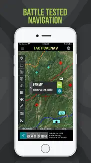
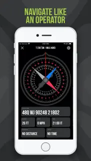
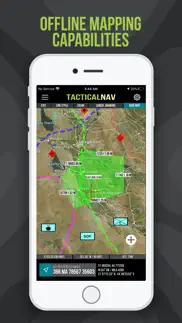
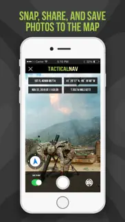


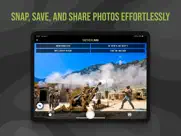

Tactical NAV 5.0.12 Apps Screenshots & Images
Tactical NAV iphone, ipad, apple watch and apple tv screenshot images, pictures.
| Language | English |
| Price | $8.99 |
| Adult Rating | 4+ years and older |
| Current Version | 5.0.12 |
| Play Store | com.appdaddytech.tacticalnav |
| Compatibility | iOS 14.0 or later |
Tactical NAV (Versiyon 5.0.12) Install & Download
The application Tactical NAV was published in the category Navigation on 14 February 2011, Monday and was developed by TacNav Systems LLC [Developer ID: 412650653]. This program file size is 49.28 MB. This app has been rated by 320 users and has a rating of 4.3 out of 5. Tactical NAV - Navigation app posted on 31 May 2026, Sunday current version is 5.0.12 and works well on iOS 14.0 and higher versions. Google Play ID: com.appdaddytech.tacticalnav. Languages supported by the app:
EN Download & Install Now!| App Name | Score | Comments | Price |
• Multiple bug fixes • Various app improvements • Coding for future updates • UI & performance refinements *A Note from Jonathan (Creator of Tactical NAV)* What’s up, guys. Jon here. I like to keep things real with you, so I appreciate you taking a moment to read this. As many of you know, I built this app downrange as a Field Artillery Captain in the Pech and Korengal Valleys of Afghanistan, and I’ve carried that mission with me ever since. TACNAV-X was born out of my commitment to honor the brothers we lost in 2010 and 2011. For me, this will always be more than software. It is a living tribute to their memory. They deserve nothing less. In this update, drawing mode is still completely free. It was previously an in-app purchase, but I don’t want there to be any barrier when you need it most, or for anyone to feel they’re being taken advantage of. Offline mapping remains available as a one-time purchase or subscription. That support is what allows me to pay my developers, maintain updates, and keep TACNAV alive. Nothing more. I’ll also be honest with you. I’ve been dealing with some significant health issues lately. Continuing to build and support this app is how I stay grounded and keep going. Bottom line, I appreciate the prayers, support, and well wishes during this time. If you have ideas, requests, or just want to reach out, you can always email me directly at [email protected]. Thank you for the trust, the support, and for believing in this app, and in me. Appreciate you guys! - Jon
| App Name | Released |
| Google Maps | 12 December 2012 |
| AMap Global | 08 September 2011 |
| Neshan Map | 04 May 2023 |
| Earnify | 22 May 2024 |
| Bluebikes | 11 July 2017 |
Find on this site the customer service details of Tactical NAV. Besides contact details, the page also offers a brief overview of the digital toy company.
| App Name | Released |
| ADOT 511 Traffic Cameras | 31 March 2023 |
| Strike and Dip | 30 October 2009 |
| BLM Public Lands Map Guide USA | 27 December 2020 |
| Moon Seeker | 09 June 2010 |
| Jacksonville Zoo - ZooMap | 25 October 2021 |
Discover how specific cryptocurrencies work — and get a bit of each crypto to try out for yourself. Coinbase is the easiest place to buy and sell cryptocurrency. Sign up and get started today.
| App Name | Released |
| 06 October 2010 | |
| Target | 24 November 2008 |
| Snapchat | 13 July 2011 |
| Google Chrome | 28 June 2012 |
| Messenger | 09 August 2011 |
Install the Giftmio extension for smart shopping. Get notified about cashback opportunities, activate cashback in one click, and save money on purchases.
| App Name | Released |
| Slime Rancher | 26 May 2026 |
| Monash FODMAP Diet | 17 December 2012 |
| Procreate Pocket | 17 December 2014 |
| CloverPit | 17 December 2025 |
| Streaks | 31 May 2015 |
Each capsule is packed with pure, high-potency nootropic nutrients. No pointless additives. Just 100% natural brainpower. Third-party tested and validated by the Clean Label Project.
Adsterra is the most preferred ad network for those looking for an alternative to AdSense. Adsterra is the ideal choice for new sites with low daily traffic. In order to advertise on the site in Adsterra, like other ad networks, a certain traffic limit, domain age, etc. is required. There are no strict rules.
Keep personal info private, avoid scams, and protect yourself online with AI-powered technology.
Tactical NAV Comments & Reviews 2026
Customer support A+. Had an issue in regards to using the offline features on multiple devices. I contacted Jon and within an hour he informed me he was working an update so that the app and its content stays with your Apple ID but currently not there yet. That’s the bad news. Good news is that he reimbursed me for purchasing it on multiple devices. True team player and excited for more improvements to an already great app! Kevin
Great App. Jon, I’ve been going back and forth for months whether to download this app or not. And I’m glad that I did. I absolutely love it. It’s a great app. You did a great job building this. I was just wondering two things that could possibly be fixed or maybe tweaked if possible. When you place a waypoint on the map, can you please make it to where the label name is closer to the icon that it is labeled on. What I want to do is label a waypoint, but also be able to zoom out a few times and the waypoints not be overlapping each other. To get a bigger picture on what my teams are looking at. When you zoom out just a couple of times, all of the labels overlap each other and you can’t tell what they are unless you zoom all the way in. Is there anyway you can make download the app on a different account such as Google Play, for my laptop, even though I have already purchased it for iPhone? I use my laptop a lot of mission planning but I cannot download it on the google play store because I have to buy it again. Maybe a “sign in” option for people who have bought it one either google play or iPhone. Thanks again for the app. I do appreciate it. John W.
Best Tactical app hands down. First off, I personally know the developer, who I served along side with in the military, and would never put out anything substandard. This app has been tested and actually used in real combat all around the world by different militaries not only the US. If you are looking for anything tactical, this is the app for you. If would like something added or change, email the developer and he will do everything to make it happen. There are other apps out there that do the same, but this was made by a combat veteran for combat applications. For the price of a few tacos, you can upgrade your phone to a combat targeting platform. Try it out, you won’t be sorry.
Effective and accurate. For background, I’m an infantryman (PSG/SFC) and Tactical NAV is perfect for dismounted operations and fires planning and integration. Most importantly, it’s accurate and also easy to use. I have young privates and numerous NCOs using this daily out in the field, and for the squad/platoon and above, TACNAV is also perfect for offensive and defensive planning and coordination. One thing to highlight, the ability to use Tactical NAV completely offline and while in airplane mode is groundbreaking (its very secure and operationally safe) compared to other publicly available and Army-issued apps and software devices out there. Bring this completely online and enable force tracking between individuals and units, and this app would be untouchable.
Tac Nav is a keeper…. Man, Ive used Tactical Nav for years serving in the military. Ive utilized this app on deployments to Afghanistan, Saudi Arabia, and its been used at home during training. Tac Nav is always an app i can depend on, it’s dead accurate, and the features that have been added to it over the years have been awesome. Like other reviewers have said, Tactical Nav can use a horizontal option, but Ive emailed the devs about it and they responded back to me the same day and told me that they’re working on it. So thanks for the great customer service guys, and for the support and work you put into the app. Offline maps is a game changer, IMO. Its been the biggest feature that me and my guys use when we operate in areas where there’s no signal. It also helps with OPSEC because we can completely use the app while it’s in Airplane mode. To the developers: Please keep up the great work with Tactical Nav and continue pushing ahead with the updates. This app has really been a life saver for me and my guys when we’ve needed it. Highly recommended. Always forward!
Great App. The possible uses for this app are limitless. Its not just for military operations; LEOs, search and rescue units, and the average civilian could all benefit from having this app. The maps pull up very quickly. The add on drawing feature has a ton of possibilities as well. Hunters and fishers could use the waypoint feature to mark food plots or fishing beds. Anyone who enjoys the outdoors should seriously consider purchasing this app. The amount of thought that went into this app is amazing, hopefully the military will adopt TacNav in the near future. A must have for any 2LT on a land nav course. Update: After a few weeks of using and checking out what TacNAV can do I’m still highly impressed. I think I’ll be adding the drawing feature in the near future.
Accuracy and reliability. As service member and a senior NCO I can put my trust in this app. Training management is a great portion of my job, and this app has facilitated the planning and execution of training for soldiers from the squad level all the way to a BDE level. Personally I have used this app to plan and execute pathfinder operations, training events and drop zone survey operations. The accuracy of the app facilitated imagery, locations and obstacles identification during air assault operations and the coordination with aviation units. I have compared this app to current systems utilized by the Warfighters and this app it’s more accurate, faster and reliable.
Impressive targeting platform. I have personally used this app in training and combat, as have many that I served with on Special Forces teams. It provides a user friendly interface, accurate location data, and a quick ability to gain targeting information. I’m highly surprised the USG hasn’t put this into official use in military units yet. It is already widely used and highly recommended amongst many SF, infantry, and artillery units and is regarded as the best app of its kind. Well done Tac NAV!
Updated review - still great!!!. Hello Sir, I wanted to update my review and tell you that your app is still working great. The updates you’ve released since my last review have been awesome. FYI, I’m really looking forward to the troop tracking feature when it comes out, as is my whole unit since we pretty much all use your app. I also really appreciate the fact that I can now instantly move waypoints and graphics around the map. This feature makes target refinement a breeze. Thank you, Sir!!!
Great app exceptional customer service!!. I am a police officer and avid outdoorsman and I have used this app for both. I have use this app for both training and live police operations. Everything from surveillance to warrant execution and it offers comprehensive mapping and target location features. I have use this on camping hiking and canoeing trips and it allows you to mark beginning, middle and end points that are easy to read and easy to share with others in your group. When I had a problem with minor bugs in the operation of the app I emailed Johnathan singer and he replied within minutes. He fully explained the behind the scenes technical work he is currently doing to fix the bugs and assured me that future updates would fix any of these issues. Customer service is absolutely outstanding. I would absolutely recommend this app to anybody with any police, military or outdoors needs!
Seems legit. Just downloaded the app and have been playing around on it. Everything seems to load up pretty quick and the features are all very intuitive and easy to use. I can already tell I’m gonna be a big fan of the compass feature and the other things on that part of the app. I also immediately bought the offline version and am very excited to get it out on some trails. The only thing I’m curious about is on your website it says that you’re planning to add a troop track function into the app, when are you planning on adding that in? I know it will be extremely useful. Thanks for what seems to be a great app I’m really looking forward to resting it out more!
Very impressive with unlimited potential.. Having worked in the combat arms community for many years now, as well as training the next generation, I can say this program is needed and has potential to help many service members conduct anything from land navigation, to fire support planning. The creator is reaching out to service members every day asking how to improve the program, so it can better assist them down range. I’ve tested this app anywhere from desert to jungle, and it continues to perform. Excited to see what else is in store for this exciting application.
Accurate and dependable. This is the best tactical app I have ever used it is very accurate. I used it during multiple training exercises in the states and Korea. The accuracy I found to be superb. As another artilleryman I know how accuracy and dependability mean the world and this app met all my needs and I was very satisfied. Tactical Nav was easier to use for me than anything out there today.
City use / Hiking uses. This app isn’t just deployable to war zones! I am a prior Army Sergeant who loves to go out into the wild and I don’t always grab my Garmin but I always have my phone! With this app I can feel at ease knowing I have the technology to find my way out of the thick of it if I get turned around! The map is as easy to view as those such as google and maps by Apple. If you are in city limits there is even store names and very detailed mapping of the area streets and side alleys! On the military side of this, the owner takes the lives of Soldiers very serious and created this to ensure those lobbing rounds down range had the best tool available to ensure call for fire was as accurate as possible to ensure the lives lost were the intended targets and to ensure those who called it in got the protection they needed! He didn’t create this app just for a dollar sign, he would put the lives saved and protected by the accuracy of his app over any amount of money, that’s the kind of guy who is putting his life into this! “What is the sound of artillery”
Phenomenal app: 5 Stars!!!. Tactical NAV is simply a phenomenal tactical app. I’m using this on both my iPad Pro and iPhone 15 Pro Max, and it’s easy to use, has excellent features for mission planning, and is extremely accurate. I used to use MilGPS, but TACNAV has won me over with its feature set and its ease of use, along with its customer service. Jonathan has created the best app outside of ATAK, and I can’t wait to see what Tactical NAV will do in the near future. If you’re on the fence, don’t hestiate. Just buy it. You can’t go wrong. And the offline mapping function makes this a gamechanger for me and my soldiers. 5-stars all the way.
Very solid tactical app!. As an infantryman, the ability to accurately plot my location and other locations is invaluable. I verified the app’s accuracy against my DAGR and a topological map, and TACNAV is spot on. If Jonathan (the creator) could get offline maps in Tactical NAV, then this app could replace everything we currently use. I’m looking forward to future updates, and it’s reassuring to know the creator is a former Army veteran too. Well done Captain!
Awesome military navigation app!. This is a great military navigation app and the offline maps feature is awesome. I’ve used this for about a year or so, and I’m a platoon sergeant at Fort Bragg and Tactical NAV has really come in handy for me. I’ve planned airborne ops using this, and have recently been using the new camera mode to share observer/firing point locations with other members to help with target analysis and MDMP. The most important aspect of TACNAV is the fact that’s it’s pinpoint accurate. Every grid I’ve pulled is within 1-2 meters of every other Army issued equipment that we have to sign for. Why use that heavy and restrictive stuff when you have an app that does it all, and then some?
Fantastic capabilities. Jonathan, I love your app and have been using it for quite some time. You and your team have made big strides over the past year in features and capabilities; keep up the great work. One area I would suggest improving soon is the waypoint database functionality. If you could square this away and add some of the additions other users have mentioned in some of the more recent reviews, you would have a pretty substantial app that is only rivaled by TS-SCI level software offered by the DoD. Great work, and I’ll be in touch via email soon to give you more detailed input.👍
Where's the promised app update. The app has great potential. We were promised an update over a year ago from the developer. The update was supposed to include the ability to plot routes via distance and direction from any given chosen point the navigator chose. Never happened. As a tactician it needs to have the ability to plot maneuverability and give simple "x" your here, you need to go to "y" but maybe "z" to "y" is a better tactical option in your planning phase. Currently.. you can't get there from here! Needs that update as promised. However I believe they have abandoned ship!
Updated review. This app has continued to exceed any standards by far excellent and accurate the newest updates for offline maps Feature will be huge ! I use this app everywhere I go and have not had a single issue when it comes to recommendations becoming reality , the all around quality of this app is phenomenal compared to every other app there is no comparison to this one. Update this app still continues to change the way the ao looks no matter where your at in the world !! Also have not received my Tac Nav shirt order yet in a long time ??
Best mil app. I have used this app for several years and had nothing but good results. The imagery is very good and recent. The coordinates are always within a meter or two within what I get from other GPS devices. The only thing that can be improved is it needs the ability to download maps for when you are unable to connect to the internet.
Essential Tool for Military and Law Enforcement. This app is an excellent tool for any law enforcement or military professional looking for a tactical advantage in any operation. The app is very intuitive and provides excellent tools for plotting waypoints and marking distinctive points of interest (ie. enemy positions). I particularly like the drawing feature which provides any number of useful applications like marking fields of fires, routes to waypoints, or interactive after action reviews. It is a must have for any leader looking to maintain tactical advantage and utilizes a platform almost everyone already possesses. Five star a must have!
Quality MGRS app. I’ve had this for a couple years, but just came back to it after using another app. TacNav has really made some killer improvements to the functionality of the app - offline maps, drawing mode improvements, speed and stability enhancements, etc. This is now probably the best MGRS/UTM app on the App Store. Can you add GPX import/export options next? That would be a great addition, along with the ability to automatically calculate the distance/direction from 2 separate waypoints. Thanks man...
Great app for diverse utilization!. This app is such a user-friendly platform where the everyday civilian and soldier can easily access and utilize accordingly. As a civilian traveling across various rural areas and cities in the US, this app has never failed me. I have navigated the busy streets of NYC and LA with this app, and then found my way around the less populated Midwest rural areas of Iowa and Ohio. As a fires intelligence officer, there is no better innovation that is easily and readily available that I would trust more. The offline capabilities is truly a lifesaver where the dictating battle environment may present those complex scenarios. This app provided our artillery batteries and the chain of command the necessary information to send rounds down range in a timely and accurate manner that saved lives! Today’s technological capabilities provides such innovative opportunities for commanders and our most senior leadership....this app answers those calls to be a cost effective and reliable resource!
Awesome App with a 5-Star Developer. So first off, this app is great. You can save precise grid coordinates, fully customizable down to the pin style and color. You can add notes to the coordinate, and then export and send coordinates via facebook, text/sms, or other options. Here’s the best part: I had an issue on the iPhone version not including a way to currently navigate to a grid via your native maps (Google or Apple Maps). I contacted the dev which opened up FB messenger and he responded almost instantly! He’s prior service Army and is happy (actually ASKS) for feedback! Get this app, pay for whatever portions are good for your needs, and if you find something it lacks, tell him and he’ll add it to the next version!
Deception!. I bought this app because at the end of the day I’m all for the boys! I want to give back to our community as much as I can! I’m a Sgt in the Marine Corps currently serving as a combat instructor with Advanced Infantry Training Battalion at Camp Geiger, NC. We train senior NCOs to be warfighters. I was looking for an offline-map tool to help me quickly and accurately build geometries of fire within an AO and show it to our studs. After happily paying 8.99 to support a brother in arms, I found out that in order to get all the features from the app I have to pay extra money for the drawing tools and sign a monthly subscription for offline mode! I support a family of 4 with sergeant’s pay, and felt like a fellow service member deceived me and took advantage of good marketing! I go to the field at least two weeks every month, and without service this app is useless to me.
100% trusted app!. This app will never leave my iPhone now that i have it downloaded and have been using it. I don’t know why i didn’t hear about tac-nav sooner! Its also pretty cool to know that one of the boys created this app and continues to develop it for guys like me who are serving in the active Army. Please give me a landscape option with ipad support, along with troop tracking, and this app would completely change the game with how my battalion operates in the field and/or overseas. Well done, Captain.
Great app, better customer service!. This app is helping me write my an operations order! It makes it so simple to analyze the “battle field”. I had a few thoughts on the app and emailed Jonathan and within a few hrs he emailed me back. We had a back and forth conversation and even went as far as to show me a few of the things he’s working on to better the app. He was appreciative of my feedback and suggestions. So far im very impressed and can’t wait to see what this app will be in a few years especially at the rate that he is working.
Awesome but... The offline as a subscription is kind of frustrating. I’d like the option to just buy it out right and have it when I want rather than adding another “bill” to the list.. maybe this could be a thing? That’s the only reason why I’m 4 staring it. Other wise 5/5 Response: Hey Jon, Absolutely makes sense from a business standpoint. I appreciate the transparency. I can only imagine from a software side as well from cost. I used the software overseas as well as stateside and it’s awesome and couldn’t recommend it enough to my boys. It’s a little tough to figure out at first but after messing with it a bunch it’s helpful. Awesome work to you and your employees making excellent tool. -Marcus
TacNav. This app is extremely accurate and is a must need. My personal experience with this system is a great one, as a Afghanistan combat veteran in the Pech River Valley I personally know the precise accuracy delivered with this app. It is by far the most impressive tool used, the ability to deliver arty and mortars along with pin pointing enemy locations for maximum efficiency in marking targets is by far in my opinion better than the DAGR. I strongly recommend this app for anyone who is serious about their need for unbelievable navigation accuracy.
Works as advertised. I used this app while on active duty as an observer, Trainer/ Coxntiller. While finding training sites in various bases and other training locations across the Eastern US, I found that this app was more accurate than the issued equipment. It was 3-5 meters accurate! I mainly used it for navigation, however the additional features are worth the additional expense as it provides a better real time picture...this is imperative for any action or plan that is. Wing executed and communicates too.
TacNav had been a valuable tool. I’ve been using this app for the better part of a decade for my job. From planning missions to just finding out where exactly I am if I feel my map isn’t updated enough. At one point I taught land navigation and when verifying points out in thick woods, TacNav would always bring me right on top of the points and help me to get in and out quickly. The few times when there had been troubles, the staff has personally responded to my questions and were already solving the problem long before I as a user had even identified. They’ve won me as a lifetime user.
Tac NAV. This app is a blessing. Tactical Nav produces when needed. I remember using this app on a few deployments when my Govt BFT would not work properly. This app allowed me to navigate the correct routes to the objective on time. I used this app also as a senior leader on a rotation in Korea. I planned, organized and brief missions and movements using this extraordinary user friendly app. I also use tactical nav while home for basic outdoor activities like hunting and planning hikes. I draw and mark up areas and hunt locations and use it to walk in the dark on exact routes to my stand location. The best navigation app I have used with the Soldier/Warfighter in mind. Produces results and always refining bases of battlefield experience. A trusted app and development team. I highly recommend this app. Chris.
a literal lifesaver !!! 🇺🇸. This is going to sound wild, but we seriously just made it out of afghanistan. the app saved our tails and helped me and my team save a large group of afghani folks before the taliban seized kabul….i know this sounds crazy and all, but this app worked great for us…the offline maps stuff also works awesome… we had atak with us as well which my teammate was using, while i was using tac nav…and they seem to make a great pair…i really wish both atak and tac nav could communicate with each other, but maybe in the future that will happen…regardless, I just wanted to take the time to share our story to the dev guys and say thank you….we really owe you guys big time, and your app did some real good for us and our afghan partners…thx again tac team!!! >>> T.S.M. 🇺🇸
Unparalleled. I have been utilizing cutting edge moving map software in my job for nearly 10 years. TacticalNav is by far the best open source moving map app available for iOS. You will not find the level of imagery clarity and accuracy anywhere else on the app store. The features embedded within the app are extremely user-friendly and continue to improve over time. This app is 100% designed from the ground up to aid in rapid grid/coordinate determination, and allows you to route plan and terrain associate unlike any other open source app available. You would need to download 3 other apps to do what TacticalNav can do. I highly encourage the use of this app. -JTAC Instructor
best tactical app i’ve ever used. this is by far the greatest tactical app you can find on the apple app store. i’ve been using this app for years now and it’s very accurate i use this with my DAGR and it give same info. i love how i can draw overlays and would love to see in future updates that you can build an overlay and share the overlays with team members given they have the app. thank you for making an awesome app.
Combat & Force Multiplier. I’ve been in the U.S. Army for almost 18 years now, and have deployed 4 separate times to Iraq, Afghanistan, and Syria. I’ve used all sorts of military equipment and devices over the years, and I say this with 100% honesty: Tactical NAV is hands down the easiest to use, and the best tactical military app commercially available today. I’ve used it for years, as do my friends, and the app continues to get better and better with each and every update. In my opinion, it beats anything the Army is fielding right now, other than ATAK. If there was ever a commercial piece of software that I could see becoming an official Army app for Soldiers, this is it.
Impressive/Accurate. After downloading the app and using it for a couple of days in the field, I can confirm TACNAV’s accuracy. Like others reviewers have said, I’m not a fan of having to pay for additional features, but they’re worth it IMO and are very useful, so it’s all good. Please add a landscape option so I can rotate the phone 90 degrees and better plot my overlays and this would be killer awesome. Other than that, this app is very legit.
Love this app!. I got this app about two weeks ago and wasn’t able to really use it in a practical setting until a recent training event. It worked exactly how I was expecting and more. It was extremely helpful to my planning process and to the success of the event. The imagery is extremely clear even on full zoom. Also Jonathan the creator has been able to help me with any questions or concerns I had while using the app! Couldn’t have asked for a better all around experience!
One of a kind.. I deployed with them 1LT Springer when we were in Iraq with 2-320th Field Artillery Regiment. Little did I know he was the one who created this! I’ve used this for probably 4 years on numerous artillery training exercises and there’s just no comparison out there. This app was accurate and has replaced what I would normally use to plot grids and whatnot for fire missions. It’s that accurate. If this app could get offline maps, a CFF and 9-Line option, then Tactical NAV could replace almost anything we use throughout the Army. Nice job Captain Springer!
Awesome app to use for any application!. Had an issue with re-downloading the app and got some of the best customer service ive ever had with re-installing it! Ive used this app before for hunting while doing some stalking for hogs. Very helpful in unfamiliar territory when u can plot your camp and see everything around it and easily make your way back. I also enjoy knowing your exact grid coordinates just in case of trouble. Will be using this app quite a bit for more hunting and camping in the future. Outstanding app! Highly recommended!!
Amazing tool. Serving in the Army I had a few leaders who always went out of the way to ensure that their subordinates knew the ins and outs of Land Navigation, Mapping reference points, and other intricacies. With this app, a whole new element exists. It puts it all in the palm of your hand, consolidated and interactive. The many feature of this app are simplistic and it has a user friendly interface that is thoughtfully laid out. While I have not operationally used this app yet, I have played with this app enough to see its value. I have had several leaders who have done nothing but rant and rave about Tactical Nav both downrange and not. I look forward to using this to teach, train, and develop future generations of soldiers and hone my own skills.
Works very well. I have used this app to do all sorts of Training operations. The ability to draw and plot. I also very much think the ability for me to take pictures on the same application with grids on the photo is extremely useful when on an objective. If we could get this on official DoD systems that are secure that would be great, since those systems do not work as advertised.
Disappointed. There's nothing more frustrating then spending your money on a product that is hyped up as being a top notch item, only to find it doesn't work like it says it does. In this case, the app will not give me exact locations utilizing UTM coordinates. Instead it simply puts me in the corner of both east/north grids. I tried everything else to get it to work, but no luck. Even more frustrating is sending questions for help to the support address via the app and email and being told the app support is no longer in effect and my emails go unanswered. This was supposed to be used for rural operations at work, but instead I got to spend money on a junk app that doesn't work and no support. There are better apps out there, I am sure of it. Don't buy this ripoff.
A must buy app.. BLUF: A beautifully designed military app that is very easy to use. Simply put, a must buy for soldiers and service members. For reference, my unit is currently en route to Eastern Europe, and the majority of us have downloaded Tactical NAV. I'm a platoon leader and genuinely find this app beneficial in day-to-day use for what I need in a military focused app. Also, after using it during a recent FTX before leaving CONUS, where we were using live rounds, mortars, and artillery fire during training, that is when I was sold on TACNAV. In my opinion, there is no other app on the App Store that compares to Tactical NAV because this app pretty much does it all, minus the troop tracking stuff, which I'm looking forward to when it comes out. I'm writing a detailed review because Jon took the time to personally respond to my email and answered all my questions in great detail, and I really appreciated that. He was a great help and I can tell he really cares about his product and his customers. Tactical NAV is a 5-star app all the way. AATW!
TACNAV is a Must Buy. Hi Jon, I just wanted to update my review and let you know that the new updates to the app are outstanding. Like I said previously, I’ve been using your app extensively for many years now, and the feature upgrades you’ve made to Tactical NAV have been nothing short of amazing. Keep up the great work, and continue making those of us stationed at Fort Campbell proud. With each update, TACNAV continues to get better and better, and best of all, you always listen to our feedback and incorporate our input into the app. In sum, please know that you’ll always have the support of those of us in 160th SOAR and 5th SFG. Thanks again, Captain. Keep it up! Chief “Night Stalkers Don’t Quit!”
Great until... Absolutely love this app, the offline mode (that you have to pay additional for, but worth it) is great, and the ability to do routes and plot points etc. My gripe is that I was inputting points when the app crashed on me, didn’t think anything of it, but when I re-opened the app, weeks worth of work literally disappeared. Pretty critical information, so I’m a little frustrated at this app at the moment
Great App. I had the tigr system in 2014 when it came out in CCO 1-327. That system was very helpful and made marking and planning a breeze. After trying tactical NAV I’m a little bias toward it now. It’s user friendly design makes it easy for the private all the way up the chain of command. I would trust this app on the battlefield and during training more than what’s out now. I’ve tried several apps when it comes to Military use and use in my hobbies such as hunting and fishing. I have been able to mark way points on big bodies of water and rivers and it takes me right back to them each time. Great app and well worth it!
Still deciding.. I downloaded MilGPS before this one and have been using it for awhile now. I like that it has offline maps without creating extra cost. I would have paid $12 to have the offline included which is the most important part. When reading through the info before purchase I did not see where it listed that as an additional cost. That would have been nice to know before purchase. The graphics for this app are great quality and the icon list is nice. It has the same flaw as MilGPS in that the border of the countries are way off. Since my team works the borders and we are not allowed to cross, this app doesn’t help in that capacity. I’ll have to refer to the other app for offline patrols and this app as backup for planning on the fly. Will keep digging into the app to see the comparisons and which one will benefit my team more out on patrols. For the last 5 months everyone have been using other apps successfully. I’m doing a trial run to see if we want to switch over since this one has better graphics and point selections than most.
Extremely solid: 5-stars. I really love this app and the variety of features it offers. TacNav was recommended to me by one of my NCOs, and it delivers. The only suggestions I can think of is to make drawings editable after you save them on the map, offer fullscreen iPad support, and include an AirDrop and WhatsApp option for sharing info and overlay data between users and groups. I’m looking forward to the landscape update coming soon and the troop tracking capabilities in the future. Those features alone would replace almost anything I’m using right now. Definitely a force multiplier.
Did you know that you can earn 25 USD from our site just by registering? Get $25 for free by joining Payoneer!
Crashing constantly. Trying to draw overlays and the app crashes constantly deleting everything. Operating on iPad Pro. Tried to periodically save overlays; however, then will not reopen them post crash.
Don't waste your money. There are better apps out there. Also the apps website states the price is USD5.99 yet iTunes charges AUD7.99 AUD2 EXTRA. Ripped off both ends. SHAME iTunes!!!!! Give me back my money!!
FUBAR. Crashes upon tapping at current location. Attempted to use in the field - was absolutely useless. Emailed "AppDaddy" nearly a month ago. Still no fix.
Can’t drop a point to a grid, clunky useability. You can’t enter a grid to drop a point, you can’t move a mount or edit it’s grid. You have to go manually hover over a grid to drop a pin. A pita to enter waypoints from a plan. No option to draw boxes, triangles or other shapes easy. I wouldn’t buy again
Viewshed fucntion. Hey mate, great app. Is there scope to add a viewshed and elevation function? Cheers.
Option to hold on update. Hey guys Any chance you can add in a button that allows the app to opened when an update is needed? I’ve been caught out trying to open up the app outside of range and it says it needs an update. But out of range so no function to just say “Later” an still use the app. Other wise enjoying using tactical Nav 👍🏼✅
Helped with locating casualty. Was working in rural remote australia without reception and came across a vehicle rollover offline mode allowed me to get co-ordinates to emergency services for ambulance, firefighters and police. also a lifesaver for Land Nav and planning routes with heaps of icons relevant to the military 10/10 would recommend, digga proof worth the money for sure
True mil spec app. I read that this app was used by the navy seals that raided Osamas compound, and it's easy to see why. Clean GUI, practical functions and super-fast response.
Imagine you at your best. All the time. Picture yourself at your sharpest and most productive. Your most alert and focused. Your most lucid, creative and confident. At work. At play. In every area of your life. Add Mind Lab Pro® v4.0 to your daily routine and uncap your true potential. Buy Now!
Good. Hooah'
Worst NAV app. Don’t waste your money this app is overly complicated, it won’t let you navigate using the map compass only, it won’t let you plot or navigate from the map, you have to enter a grid reference, or other forms of information it won’t just let you pick a location on the map to navigate to.
Does not function as intended. Bought this App to help out on a Nav Ex, but it crashes every time I attempt to enter a MGRS. Couldn't plot a single WP's or Nav point, let alone come close to establishing a route. Wouldn't recommend unless you solely wish to use for MGRS with grid overlay on google maps.
Missing fonction. Good but he miss pre-form (square of circle) and free form text.
Not impressed. Crashes when you open it. Does not allow creating waypoints or show routes. Save your money and use built in compass and iPhone map
Having issues. It crashes a lot and if your not moving The direction from your position jumps all over the place. And I don't like that you have to set way points to get a direst ion of travel on the map
It’s ok. Just.. Read the description completely. The drawing feature is another $8.00 purchase. My fault for missing that tad bit of info. Outside of that it doesn’t really do anything more than the abundant free apps out there. If your looking to use this in a military context. Save your money and get your supply system to get you a map protractor and mil symbol protractor.
No Altitude. Gives options for measurement, but does not give a final measurement.
Stellar. Not sure what other people's problems with this app is but it is right on the money. No electronic device should ever substitute solid navigational skills, but if you good nav skills, this app is a solid piece. Don't regret the $5. Particularly love the tactical red overlay.
Bluetooth to helmet cam. Can you please update this so it can connect via bluetooth to a helmet cam (ie: contour gps)?
Computer NAV on the go!. Beginner to veteran, look no further in navigation system with solid symbology overlays. Hiking? Check. Middle of the ocean? Che- maybe. But hey, stuff’s good bub.
Broken. This app wasn't bad when I got it a year ago. As long as i had service I had a decent back up tool. Then, it all went wrong 6 months ago. At first I couldn't search grids, then I couldn't set wp, or routes without it crashing. Now it won't even open. FIX THIS APP!!!
Waste of Money. This company uses patriotism and the good name of the American Military to sell this app. Three crashes in 10 min and it can't do what it says in the AppStore write up. Don't buy it. I am giving it one star because of the freaking cross hairs that I just spent $5.99 on.
Adsterra is the most preferred ad network for those looking for an alternative to AdSense. Adsterra is the ideal choice for new sites with low daily traffic. In order to advertise on the site in Adsterra, like other ad networks, a certain traffic limit, domain age, etc. is required. There are no strict rules. Sign up!
🇺🇸 Awesome 🇺🇸. Probably the coolest developer I’ve ever communicated with. Very down to earth and insanely helpful. The past few updates have been amazing, and TACNAV just keeps getting better and better. Thank you for listening to my feedback, Sir!!!
Great until... Absolutely love this app, the offline mode (that you have to pay additional for, but worth it) is great, and the ability to do routes and plot points etc. My gripe is that I was inputting points when the app crashed on me, didn’t think anything of it, but when I re-opened the app, weeks worth of work literally disappeared. Pretty critical information, so I’m a little frustrated at this app at the moment
App is great but iPhone app has a glitch. When you try to share a saved created route, whoever is on the receiving end for iPhone can’t open the tacnav file on their end. Fix this and will change to 5 stars. That was the whole reason why I paid for this app. So I could create and share routes with my team.
Must have app!!. TacNav came highly recommended to me by my peers. As a SFC in the active duty army, it has assisted me in developing training plans and I’ve used it for land navigation training for myself. Nothing better is out there. Highly recommended
Almost perfect. Great app, super intuitive and easy to use. I only have two complaints. One: it’s impossible to get distance in meters and target elevation in feet msl; it’s either metric or standard for both. Two: the app only supports portrait orientation. It would really help if we could flip our phone sideways and get a wider map to look at.
Great app but…. Look I love the app. Nothing wrong with it except the fact after I updated it, I keep getting the notification in app asking for me to update it. I can’t even access the app anymore because of the constant asking of update even when it’s updated! Please fix
Landscape orientation. The app is wonderful! My only issue I found with it so far is that, from what I have seen, the app won’t let you orient the application landscape. Small little detail, but I think it’s necessary to all for flexibility for presentation and navigation.
S Miller. This app is absolutely top shelf! The more we use it the more we like it. Great app from a great guy. The developer is incredibly responsive. Thank you for putting this out!
Awesome application. As a forward observer in the army using this app is very helpful when sitting on an observation point. It allows you to set wave points and pull accurate MGRS for target processing. I recommend this application to all who are looking for a good app that actually works in regards to military use. Very tactically and technically proficient.
Good one but can be better. I just downloaded and played with it for a little bit so far great one other then there is no search window or Option to inter a name of a place and then be able to see that place and once you zoom in with satellite map does clearly show as Google earth or other maps do please fix these two and then I say this is a 5 star app!!!
Offline mode costs $$. I’m fairly certain when I got this app I paid $9 for it and could download maps to my phone. Now that I’ve returned home from deployment I can no longer use this app for what I assumed was a main feature and main reason why I paid for it in the first place, offline maps. Without paying for the offline subscription this app is useless and I’m no longer getting my $9 worth. It’s getting deleted.
Great app!!. Best military navigation app on the iPhone. Period. I use it everyday. Awesome developer support as well. Jonathan is super helpful and is always there to help me if I ever have questions. 5-stars all the way!
Awesome MGRS NAV App. I spent some time looking for a high quality MGRS app to use in and around the backwoods of the Colorado Rockies and decided to give Tac NAV a try. Really glad I did. Love the features and look forward to getting a lot of use out of the app. Thanks!
Worth every penny. Excellent app. Would like to see some kind of measurement tool included in the future so I can get a distance and direction between two points, but overall, Tactical NAV is superb.
Great- But could be greatly improved. This app seems great to use but can be difficult. Here are my issues: 1. I purchased offline maps, yet for some reason the app refuses to show a map when launched without Wi-Fi. 2. Despite being “precise” the app really can’t zoom in too much as in I can’t see simple things like cars and boats so you have to squint to see props like that, I’ve seen clearer, more updated satellite imaging from google. 3. Improve the pinpoints/POI’s 4. Difficulty removing drawing, I click on the end pieces to delete and it’s either hard to click or plainly refuses to give me the UI to do so I would love for these issues to be addressed as I plan to use this app often.
Great app. This is a great app with even more potential than it already has. I have 56 months in country stacking bodies and this would be useful. Plus the draw add on is awesome. The developer John is responsive and if I can figure it out anyone can
First look seems solid. After initial digging around in the app, it looks like it’s going to be great. Seems useful, accurate, and has some great features. I particularly like the inclusion of NATO Joint Military Symbology. Looking forward to putting it through full paces in my next land nav course!
5-Stars!. This App has met and surpassed my expectations! Not sure what I was going to get compared to other apps I have been experimenting with but am honestly glad I came across Tactical Nav as I can finally stop searching. This app is very accurate and easy to use compared to other out there.
Great App. I use this App on a regular basis. Extremely accurate and easy to use for anyone. I originally got this app to use during my hunting trips, but I end up using this app during my sales calls throughout the week.
Perfect. This app is great. From getting the job done to just finding your way around this app is perfect. Multiple features that help make the job that much easier for you. Love the constant updating! Look forward to what’s next.
Very easy and useful. Just downloaded the app and it looks amazing. Although I am no longer in the Army I can see myself using the shXt out of this app since I love to be in the woods a lot. It it really easy to use thus far. Looking forward to getting real use out of it when out hunting and tracking.
Excellent Targeting Reference Tool!. For on the go geographic reference and situational awareness, there is no other app that compares. The imagery’s always up to date (matching what you see on the ground) and ACCURATE! As a career Joint Terminal Attack Controller Instructor/Evaluator and operator there is no other tool that I will ever use to conduct JTAC training. Thanks for the APP!
Multipurpose navigation. This app is everything I’ve been looking for, I can use it for work purposes and recreational as well, I do a lot of hunting and snowmobiling in my free time and I can count on this app to help me no matter where I’m at.
Been a great help. Excellent application. Have been using it for years both Stateside and OCONUS. Worked for regular civilian application as well. Highly recommend and spend the time needed to learn how to properly use the application.
From a Lehman’s point of view, this thing rocks. Tested out in my water & land filled geography in Tampa Bay. It works. Super accurate & reliable & gave me exactly what I was needing as I navigated the geography. I was able to navigate areas I did not know easily with zero lag when other apps do not update as quickly. Quickly became my go to for navigation!
Great product. I downloaded this app when it first came out and have been super excited and happy for all the updates. You can use this app in the field or on the street. It’s user friendly and the interface is pretty simple to understand. I would definitely recommend this app to anyone who enjoys a good GPS.
Tactical NAV awesome app. I use Tactical NAV at work on a daily basis for training and navigating to a location by use MGRS grids. This app works flawlessly. Worth every dollar spent on the app. Makes my job easier and I don’t have to depend on a normal gps.
TACTICAL. I have used Tactical NAV for about a year now. Within the Fort Sill enclave I have plotted most of the ranges and Training areas, it really helps me plan routes and get the game plan together, The Location feature seems to be +/- 2 meters when compared to a DAGR. I have had no issues Honestly I tend to use it more in my off time. I mark fishing spots and more. This app has guided me out of the Sand dunes at Glamas CA. And had held the location of drift wood that I plan to one day take home! Great work, really looking forward to the update where I can use a downloaded PDF forest service map within the App!
Possible new feature. This app has been a life saver for my site recon. I would love to see, if possible, a feature where you can add photos from the device gallery. I am giving 5 stars because is a well thought and developed app.
Great App for boating too. My wife introduced me to the application a couple years ago. I wasn’t sure how I could utilize it at first. I realized that I could leverage the pins for fishing spots and marinas ad well as good locations along the River. Further we use the app while hiking to check out whereabouts and elevation. Great app.
Wow, impressed!. Regardless of your use, this app is highly accurate and very helpful when living away from home. Efficient and timely, it helps me get from place to place. Love it.
Awesome and versatile. My husband and fellow troops used this when deployed and I’m so thankful they had it. But we have found it to be equally useful in our outdoor activities. I hadn’t expected it to be so versatile. Thank you for providing a great tool for our troops and for our rec time. This app rocks!!!
Best app on the market. Not only does it do what I need it to do it’s very reliable.. allows me to find any location I need for work that other maps can’t reach thank you so much for he amazing work you put into this app
US Army/Soldier use. Awesome app with insanely accurate MGRS grid location(s). If you could incorporate CAS 9-lines, Call for Fires, and 9-line Medevac requests into the app, this thing would be untouchable. Much better than any DOD GPS system out there.
Prompt service. The app is excellent as a part of terrain analysis with satellite imagery and and accurate MGRS checks. When I experienced an issue with the app, I was able to reach out via the contact information on Tactical Nav's Facebook page. There prompt service and outstanding customer service makes for a valuable resource all around!
Remarkable app. Fantastic update to an already remarkable GPS/tactical app. Landscape mode works beautifully and I will submit any issues I find with the latest version to help your dev team. Keep up the great work man.
TACNAV rocks!!!. I am really amazed at the usefulness of this app and all the features it offers for not a lot of money. I normally don’t write reviews for apps, and I was originally told about Tactical NAV from a couple buddies in my unit while we were out in the field. No regrets and more than worth what I’ve paid. Great job!
Excellent product. I’m a 20+ year veteran within the combat arms side of the military. Our mission is to locate, close with, and destroy the enemy by fire and maneuver. This app would have made that task dramatically simpler. It’s even fun & useful stateside, whether that be by law enforcement or civilians.
Effective and Accurate. Using this app for reference is flawless and is especially helpful in the field. This system enables me to have my own GPS in conjunction with BFT if I’m out of my vehicle as well as it helps spot for executing battle drills during training. It is accurate and is flawless even when I don’t have service.
MosulMax57. Just downloaded the Tactical NAV App! What a great tool to have at your disposal. Any hard charging Marine or Army grunt needs to own their battle space and get this tool! I’ve only played with it for a few hours, wish this would have been available when we hiked the Appalachia trail!
Outstanding app!. Very solid nav app! Easy to use, great functionality, excellent customer service (thanks Jon), and the accuracy is spot on. Just needs a landscape option, but I hear that’s coming soon. 5-stars all the way!
Excellent Product!. This is app is amazing and works just like it is described to work. It has many functions and the user interface is easy to use! It’s very accurate and I’m very happy with it! Highly recommend!
Love this App!. This is by far the greatest APP I have ever purchased! For the combat Veteran, Sports enthusiast and even the novice that is looking for directions, this App has it all. Best compass, Gps feature I have ever used! You won't ever go wrong by purchasing his App and most importantly, you will never get lost using it!
Best Navigation App. As a soldier who has served in the Artillery branch as well as in Aviation this app is vey impressive. I have verified it’s accuracy against a DAGR and my personally owned GPS and it is spot on. Possibilities for this apps use are endless. Looking forward to using this app for Moose hunting in the mountains this fall!
Easy purchase. Great update man. I’m a TACP training to be a JTAC, and this app is sick. Very easy to use and extremely accurate grids. Any plans for blue force tracking and CAS 9 liners? Like some of the others that left reviews a landscape option would be awesome for our plate-carrier mounts. Thanks bro.
Best App of its kind on the Market. This App is Amazing in One word. Not only has it already saved military members lives, but it makes firing artillery from a cell phone and not a thousand dollar piece of crap that barley worked. Also I have found this VERY helpful in other aspects of life. I also use it to help with my outdoor activities. All in all I couldn't be happier.
Developer is awesome - Solid updates and good feedback.. I wrote a critical review a while back and noticed the dev responded with some super helpful information. Switching this to 5 stars - I use it a ton and after moving to an area that actually has decent reception I have noticed just how great it is. Solid stuff.
Superb land navigation app. Drawing mode is my favorite function of this app. In future updates, I would love to be able to navigate waypoints, but for now, the app is really spot-on accurate. Almost more accurate than a DAGR at times.
Great for my business. I own a electrical business that deals with billboards and this app helps me send crews to hard to find locations and get precise measurements for long wire runs. We have used it several times with state and local governments to get easements and setbacks for new board installs. Much easier than using local county’s websites.
Stable & Accurate. Superb MGRS app. Had a question about one of the features and received an email back from Jonathan in like 5 minutes. Can’t beat customer service like that. Love the update and keep up the good work.