RiverApp - River levels App Reviews
RiverApp - River levels App Description & Overview
What is riverapp - river levels app? Get quick access to the latest river levels, flows and conditions across the US and more than 20 other countries worldwide.
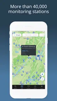
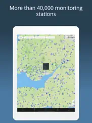
RiverApp gives you access to one of the world’s most comprehensive hydrometric datasets, with data from over 40,000 monitoring stations.
Whether you kayak, canoe, packraft, paddleboard, fly fish, surf rivers, manage irrigation, operate hydropower infrastructure or monitor flood risk, RiverApp helps you stay informed with reliable, easy-to-read river data.
FREE FEATURES
‣ Current water levels and flows for over 20,000 rivers
‣ Water temperature data where available
‣ Detailed maps of hydrometric stations and whitewater sections
‣ Custom alerts for each station when a defined level or flow is reached
‣ Favourite stations and whitewater sections for quick access to the latest readings and conditions
FREE FEATURES FOR WHITEWATER SPORTS
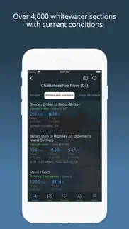
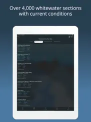
‣ More than 4,000 referenced whitewater sections
‣ Section conditions based on current water level or flow
‣ Detailed section maps with quick access to put-in and take-out points
‣ Hazards, rapids and other points of interest, including photos where available
‣ Information on difficulty, length and average gradient
‣ Community-based addition and editing of whitewater sections
RIVERAPP PREMIUM
Unlock additional tools for deeper river monitoring and trip planning:
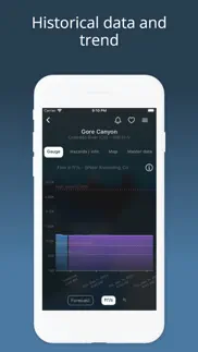
‣ Historical water level and flow data going back several years
‣ Forecasts for selected stations
‣ Satellite map layers from multiple providers, with comparison tools
‣ Customizable Home Screen Widgets to keep your favourite river gauges visible at a glance
‣ Monthly streamflow statistics to understand seasonal variations and plan river trips at the right time and place
DATA SOURCES
RiverApp brings together data from over 100 official and public hydrometric sources worldwide, including, among others:
NVE
California Data Exchange Center
Government of Canada — Wateroffice
USGS
NOAA
PEGELONLINE — www.pegelonline.wsv.de
HVZ Baden-Württemberg
HDN Bayern
Kanton Bern
Ennskraftwerke
Land Kärnten
Land Niederösterreich
Regione Piemonte
HVZ Rheinland-Pfalz
Český hydrometeorologický ústav
HVZ Sachsen-Anhalt
Land Salzburg
Scottish Environment Protection Agency
Slovak Hydrometeorological Institute
Agencija Republike Slovenije za okolje
HWZ Steiermark
BAFU
HNZ Thüringen
Land Tirol
Shoothill
Vigicrues
Serveur de données hydrométriques temps réel du bassin Rhône-Méditerranée
Land Vorarlberg
Bureau of Meteorology — Australia
DISCLAIMER
RiverApp is an independent application and is not affiliated with the listed organizations unless explicitly stated.
RiverApp and the listed data providers shall not be held liable for any errors, omissions, delays or interruptions in the information provided, nor for any loss, injury or damage of any kind resulting from its use.
😍 Do you love RiverApp - River levels app? Please share your friends!



Please wait! RiverApp - River levels app comments loading...
RiverApp - River levels 6.0.2 Tips, Tricks, Cheats and Rules
What do you think of the RiverApp - River levels app? Can you share your complaints, experiences, or thoughts about the application with Florian Bessiere and other users?


RiverApp - River levels 6.0.2 Apps Screenshots & Images
RiverApp - River levels iphone, ipad, apple watch and apple tv screenshot images, pictures.
| Language | English |
| Price | Free |
| Adult Rating | 4+ years and older |
| Current Version | 6.0.2 |
| Play Store | de.riverapp.iphoneapp |
| Compatibility | iOS 17.0 or later |
RiverApp - River levels (Versiyon 6.0.2) Install & Download
The application RiverApp - River levels was published in the category Weather on 04 July 2013, Thursday and was developed by Florian Bessiere [Developer ID: 667012476]. This program file size is 45.43 MB. This app has been rated by 4,510 users and has a rating of 4.8 out of 5. RiverApp - River levels - Weather app posted on 07 July 2026, Tuesday current version is 6.0.2 and works well on iOS 17.0 and higher versions. Google Play ID: de.riverapp.iphoneapp. Languages supported by the app:
CS EN FR DE IT NB Download & Install Now!| App Name | Score | Comments | Price |
-> Bug fixes
| App Name | Released |
| Zoom Earth - Live Weather Map | 27 June 2023 |
| Solar AI - Tanning Assistant | 21 May 2025 |
| UV Index Widget - Worldwide | 03 May 2016 |
| NOAA Weather Radar Live Map | 09 January 2024 |
| Moon Phases and Lunar Calendar | 27 June 2016 |
Find on this site the customer service details of RiverApp - River levels. Besides contact details, the page also offers a brief overview of the digital toy company.
| App Name | Released |
| Wx for iPhone | 28 July 2011 |
| RadarOmega | 14 March 2019 |
| World Tides 2025 | 17 November 2024 |
| Xasteria Plus - Astro Weather | 15 September 2020 |
| Hurricane Center | 10 October 2010 |
Discover how specific cryptocurrencies work — and get a bit of each crypto to try out for yourself. Coinbase is the easiest place to buy and sell cryptocurrency. Sign up and get started today.
| App Name | Released |
| PayPal - Send, Shop, Manage | 03 February 2019 |
| 07 April 2016 | |
| 06 October 2010 | |
| Telegram Messenger | 14 August 2013 |
| 09 October 2009 |
Install the Giftmio extension for smart shopping. Get notified about cashback opportunities, activate cashback in one click, and save money on purchases.
| App Name | Released |
| Streaks | 31 May 2015 |
| Ouros | 14 August 2024 |
| AnkiMobile Flashcards | 26 May 2010 |
| Scritchy Scratchy | 18 March 2026 |
| Farming Simulator 26 Mobile | 19 May 2026 |
Each capsule is packed with pure, high-potency nootropic nutrients. No pointless additives. Just 100% natural brainpower. Third-party tested and validated by the Clean Label Project.
Adsterra is the most preferred ad network for those looking for an alternative to AdSense. Adsterra is the ideal choice for new sites with low daily traffic. In order to advertise on the site in Adsterra, like other ad networks, a certain traffic limit, domain age, etc. is required. There are no strict rules.
Keep personal info private, avoid scams, and protect yourself online with AI-powered technology.
RiverApp - River levels Comments & Reviews 2026
Ridiculously Awesome. I’m a biologist that spends his life (and free time) on rivers throughout the US. This app is amazing and completely worth the pro upgrade. I use it dozens of times per day and recommend it to everyone.
Great app!!. Has everything I need. Fast response time to fixes!!
Hey - A developer that responds!. Purchased premium and was scared when the future forecast for my favorite river locations weren’t showing. 24 hours later and all seems well. I would like to note that I emailed the developer and they responded very quickly A+++!
Best app for paddlers. More info from more gauges than Rivercast. Plus a more user friendly interface. Definitely go for premium for $9.99/forever to get access to forecast info.
Wow. Incredible app, very useful for water levels. Will even show put in and take out spots on the map. 5 stars!
Best Whitewater Level App. This is the best app I’ve found for monitoring river levels for my favorite runs. This will display flows in feet and CFS right on the summary page. If your favorite gauge has temp it will display that as well which is great for knowing how to dress. The color coded low-med-high levels for favorite sections is great too. I’ve submitted a few of my favorite sections around the mid-Atlantic and the developer was very responsive for getting them added.
Map isn’t working. The app is fantastic. I love it. It is very helpful. My only issue is when I try to use the map feature it keeps telling me there is no internet connection. It never goes away. Must be a bug.
Nice but. The horizontal lines and the colored indicates that say if a river is high/medium/low have completely disappeared for me on the locations I frequently check. How do I get these back?
Very Nice!. Allows for notifications to be sent to phone, nice feature!
Extremely Useful & Always Updated. Has all my local rivers and creeks and is updated frequently. Extremely useful and much easier to use than the USGS or other services.
Clean and fully functional interface with reliable data and push notifications!. This is exactly what you need at a moments notice when you’re looking to get out on the water. Lovely app
Recommended app!. I love this app. Although it updates slower than I would like it to, it doesn’t bother me to much. The graphics are outstanding and the charts are easy to read and understand! I would highly recommend this app to any whitewater kayaker who is looking for an app such as this one.(@jjmp1298, the premium won’t give you future water levels unless it is dam released. Natural water flow is impossible to predict)
Great and accurate app. Great visual graph of river levels. Uses official NOAA and other data sources. Love the alert feature.
Great app!. I love this app!. I use it a lot for kayaking, checking river heights, flows. Very helpful that you can expand history to compare where the level is now against what it was a week ago, or a mont or more ago. Great app!
The Information is ok, but ...... Editing this review.... the developer worked with me and updated the app and now it works perfectly.... changing review from 1 star to 5! I purchased this app after I upgraded my phone and my previous river level app was no longer available. I PURCHASED the app which won’t acknowledge that I did purchase it and won’t allow me to use more than the free app features. When I click restore purchase, nothing happens.
Best app for kayaking ever. The free versions is everything you need. I bought the premium just to support the app creators honestly. I check this app before every run, and it’s even helped me find runnable river sections nearby i had no idea about. Wicked good app and looks clean too👌
Great river levels app. Finally found an app that gives me all the info I need about my favorite rivers and current conditions.
Love this app!. Want to have a good idea of what your favorite creek or river looks like before investing time and gasoline to get there? RiverApp!! Had a great day on the creek fishing? Save your depth, flow rate and temp for future trips!
Perfect! (There’s some real stupidity in the comments). Great UI and layout, not buggy at all. Nice clear font, good map which loads faster than any other river app. You can tell this developer actually cares about his users, and so I subscribed to Premium. Highly recommend this for river anglers! To some of the negative reviewers, if you want to guesstimate the future river levels, consider dam release and upcoming rain forecasts. There is no way to possibly “forecast” a river height. Don’t be an idiot.
Excellent information. Displays up to date data in a really user friendly format.
RiverApp. Needs to update more often it’s afternoon and it’s stuck on early morning
Notes. This app is awesome! I think having a feature where you can save notes on specific rivers would be cool. That way someone can document what time of year and what CFS they ran a certain river and section, and can reference that saved note for following years. This would be great for planning in the future. Knowing what CFS was good for your trip and skill levels and what CFS you’d never want to run again. I use this app all the time and I love it! Thanks
No communication. App is good but when you try to communicate whomever runs it via their email, you won’t get a response. Gadge is off by 1800 cfs versus California Department of water resources.
Good app. Good app if you want current information. I subscribed to use the forecast feature and it worked well for a couple weeks. But now the forecast doesn’t work.
Charting over custom dates is awesome. Okay on my second use this app rocks. First time trying to chart custom dates for the owyhee in Oregon was frustrating, but low and behold they sent me an instructional video. Problem solved. Keep it up folks!
Accurate and Reliable Data. I am a Lockmaster at a Lock and Dam on the Mississippi River. The data representation on this app is by far the best I have seen, it is even better than the Corps of Engineers own app. It includes a nice function with the level alarm that sends you a notification when the water level reaches the user defined level. The Premium is definitely worth it.
Going down hill. I’ve used this app for the past several years keeping a close eye on the gauges in my area. Lately they don’t seem to work much at all. I know it’s not the gauges themselves because I can login on other websites and see perfectly fine. Not sure what’s going on.
They Just Messed Up 5 Star App. This was a 5 star app until this upgrade. I used to be able to trace on the graph and the time and flow at that time would show. It no longer does that. I used that feature to calculate flow at a certain time based on past history. Now running my finger along the graph it stamps info for the time I land on initially, but then the whole graph begins to move. I am not sure why this was done but you ruined a great feature of this app. I now need to find if there is another app that has something similar, or, you need to put that back.
Great for hydroelectric plant operators. I work at two small hydroelectric dams on the Chippewa River in Wisconsin and we use this app to see exactly what the water flow is to help us adjust the generator governors and I upgraded the app so I can see flows at times like the past spring snow melts. I can’t go a entire day without using the RiverApp.
Missing information. There are a lot of important gauges missing in the Pacific Northwest area. I have sent multiple requests and I haven’t received a single response from anyone. It’s disappointing having an app that doesn’t have any support for their product. Update: I was contacted by the developer to send an email to update. I sent an email right away and still no response. Poor customer service. Downgraded to 1 star
Premium. The premium is almost pointless cause it does not show the expected crest levels just the current water level
Disappointed not what I needed. The app works well. The graphics are good and it’s eye catching. My complaint is even with the premium addition it does not show river predictions. It only shows current river levels and levels from the last month. I wanted river predictions so I could get an idea what river levels may be for the up coming weekend.
My daily Go-To app for my whitewater addiction. Hands down the best reference app for river-sport enthusiasts - at least in the US. Even better than American Whitewater’s excellent app. I love being able to add river sections, park-n-play & surf spots which sometimes get added to the global dataset. :-) Still hoping a journaling feature will be added!!!
Love it. Always accurate. So easy to use. Worth the premium
Excellent River Application. I use this app almost everyday to update my favorite tributaries I fly fish. The application is so easy to use and I think anyone who needs to know about the water level or water flow should get this app.
Excellent app. Easy to use, includes not only CFS but routes and if the level is ‘runnable’
This is the best river flow app I have found. Has my favorite river flow gauges. Just wish it had an alert feature that lets me know when my favorites reach a minimum alert level!
Can’t restore premium. Upgraded to iPhone 12 and the premium version doesn’t restore. Developer doesn’t respond to emails to correct. Customer service is basically non existent. Developers solution to failure to restore is buy the app again and see if Apple charges you. Really! This is your solution? WOW. Do not but imo
Great, but can we get some graph adjustments. Truly love this app, I use it to track river levels for fly fishing. However, the graphing makes little sense as it often starts the Y-axis at negative values, which it obviously should start at 0. Can you guys update to fix that? It would really help put levels in context better
TTD. This site is very user friendly. No hassle navigating this website & the next thing you know your checking your river flow in real time from 4 different points of interest.
Great App!!!. I have been looking for a user friendly application and stumbled upon this one. Not only is it user friend but the design is beautiful. I monitor river levels at work and this application has all of them. A bonus is that you can enable push notifications based on min/max flows at specific gage stations. I have contacted the developer about adding additional stations and received immediate response even on a weekend his is a five star application for sure. Thanks for the great effort and an application that solves a number of problems for me.
App not giving cfs on some rivers anymore. I love this app but out of no where it is not giving me the reading in cfs anymore and only giving it in feet. Please fix this because I have relied on this app and now I have to go straight to American whitewater’s website.
Riverapp. I don’t like how you cannot look at the forecast predictions only just the past dates. Seeing as I use this for work and the river changes all the time I would like to know what it is in the future
Great for Anglers!. I use this for all my fly fishing trips. Premium version is great; I use alerts to let me know when my favorite rivers are at fish able levels and use historic flow data to help record fish behavior and fly pattern effectiveness.
The One and Only. I use this daily in the summer. Buy it!
Love it. This with a few more apps, Lets me know everything before I leave
New Boat Owner. Great app to have. I use it every time I am planning my trip and while I’m on the ester. Very accurate and extremely helpful!!
Used for fishing. I use this app for fishing a portion of a tidal river whose tide differs by several hours when compared to the tide levels at the inlet (where all other apps show readings from) and it has been spot on so far (2 mos of use). Highly recommend if need something to determine/predict an inland tide on a tidal river.
Not only for kayakers. I've been using this for years to check water levels and just purchased the premium version more to support the developer than due to a need for additional functionality. I use it all the time and it's great. Note for the developer: I'm a fly fisher, not a kayaker. Seems like you could broaden your base by emphasizing that it is not only useful for those who kayak.
Fishing. App is very useful to determine when the river flow is safe for wading. You can set the alarm and get a notification.
Did you know that you can earn 25 USD from our site just by registering? Get $25 for free by joining Payoneer!
Geographically incorrect. No problems with using Open Street Map as the base but the provided geographic areas are wrong. There are States and Territories in Australia!! The capital of Australia, Canberra, is in the Australian Capital Territory, not in New South Wales which is the only option. The Northern Territory, which is larger than most countries is also missing? Having to just navigate on the map to find the correct areas is slow. Please also add the option to read heights in millimetres (mm) to account for low river gauges.
Imagine you at your best. All the time. Picture yourself at your sharpest and most productive. Your most alert and focused. Your most lucid, creative and confident. At work. At play. In every area of your life. Add Mind Lab Pro® v4.0 to your daily routine and uncap your true potential. Buy Now!
Edmonton area rivers. Great data, very helpful in planning outings! Has really improved our paddling days. Rob
Great app for any whitewater enthusiast. Awesome app
Great app. App works for many rivers and is easy to navigate
Simple and so useful. The app is easy to use and provides great detail. If you paddle rivers it’s simply an amazing resource.
Very unhappy since updating.. The app used to be great for looking at river levels on various rivers. I just updated the app and now it only lets me back 2 days. It used to let me look back further to see a better picture of if the river is on its way down or up, not just a daily spike. If I want the app to function as it has for months, I now have to pay. Shame on them, my review went from 5stars to 1 with that simple change.
Great app for anyone paddles!. This is such a great app and I find myself using it everyday just to check levels. Gets me stoked to go paddle. Thanks!
River app. Sometimes when you really need it it’s not updated
Excellent. The app does a great job in collecting river data all in one place. The beta section needs more users contributing before it will be truly helpful.
Need more river from Quebec!!!. Work well ! But need more river from quebec !!!!!!
Good app!. Works well, best mobile river app I've seen.
Great resource. We use river app on a daily basis as part of our operation and risk assessments. Takes some of the guesswork out of the equation.
Adsterra is the most preferred ad network for those looking for an alternative to AdSense. Adsterra is the ideal choice for new sites with low daily traffic. In order to advertise on the site in Adsterra, like other ad networks, a certain traffic limit, domain age, etc. is required. There are no strict rules. Sign up!
No historical data in free version. Bummer.. No historical data in free version. Bummer.
Use free app only. Don’t buy premium!!!! Nothing different except date range....no forcasted levels like it says!
Used to be 5 Star. This was a fantastic 5 Star app, then , I went to check the flows on the Salt River today and now I have to pay for “Premium” to get historical data. What a bunch of crap. Plenty of free resources out there I will use from now on.
Best. Worth upgrading! Use it every day
Kim Poach. I have used this for a couple of years great app!
River app. This is a great app to monitor water levels and temperatures. I’d give it 5 stars but they don’t have courtois on here
Great App. My go to river levels app.
Needs to update hourly. Thought this app was going to be great for kayaking but kayakers need to know every hour on the river levels this app does not update with USGS every hour like it should!
Faulty information. Just went through major flood in Pickensville, AL. RiverApp consistently displayed data points feet higher than actual readings from the Corps of Engineers.
Awesome for Idaho and oregon. Been great for Idaho and oregon .... great maps as well
Great App! Use weekly. Really like this RiverApp! Need a place for personal notes. A graphing page for seasonal flow variations would be helpful for trip planning.
Needs options. Needs option to sort rivers geographically by drainage rather than just alphabetically within state. When pulling up a river, need to have gages sorted upstream to downstream rather than alphabetically.
River app. I would like to see a monitor at the Hwy 63 bridge near Vienna,MO how can we get one there because there is a lot of distance between Jerome and Rich Fountain.
After upgrade???. Don’t do it. I thought I could look back/charts 1yr maybe 5....it clearly needs work.
Hi I Am Danylo I am his brother looks cooler brother. Hi I am Danylo I am his brother cooler brother
River App Rocks !!!. Great to have these world river flows at my fingertips 🌊Thank you .
Waste of 10 bucks. Great app for the free version. Premium really has no value. I thought I would be getting a forecast of water levels instead it is historical data.
No your app won’t work. Apparently no you can’t pick up Internet in my house or anywhere
Worthless. Just purchased this app to show local river levels and one river has not been updated since Feb of 2021. Don’t waste your money.
Just ok. Data not always accurate and updates can be slow
Jkk255. Awesome!
What once was cool. Super useful until I had to pay to see more than two days back
Does Not Work on certain rivers. This app DOES NOT work with Levisa Fork River in KY
Premium?. All data available from army corps app for free.
Awesome. A lot of great information on here!
Very helpful.. My old River Reader app was locking and found RiverApp to replace. I like RiverApp much better to monitor river conditions where I live.
Wildlife. Great resource
Nice but needs help. Love this app but wish it gave you the flood stage for the rivers. Need to go to NOAA to find that.
Thanks. Works very well
Looks nice.. Haven't used it yet,but it has what I need. Looking forward to my first use.
Finally!. Been hoping for an app like this for some time... They nailed it!
Not for fisherman. App is missing river flow info for major fly fishing spots in Colorado like the dream stream, middle fork, and south fork of the South Platte. Don't waste money or time with this app.
Love This App!. Great UI, functionality and data. If you stream fish, download this app.
Great app. Great idea it will only get better.
Add a creek. Can you add Worley Creek for Tuttle Oklahoma
Kayak lover. Lots of data really useful tool
River.. Have used this app for several months now and have realized that the CFS seems to be correct but the feet of the rivers are off by as much as 3 feet over actual.
Requires payment. Was a pretty good app until it started making a pay a premium fee to access data that’s past a day old
Great!. Love the app and you can make a favorites link! Super cool
Excellent tool. Great app for river levels.
Very good. Love this app,I liked it so much that I bought the pro version, covers all the rivers I paddle in western PA
Easy. Good app
Use it all the time. Good layout. Update is great
Hate the update!. The other version was much better! This feels cartoonish
No flow Rate. It would be nice if you could see the flow rates and water temperature. (Maybe I’m just not seeing it?)
Brilliant. Fantastic app. I can track all my favorite spots!
Changed. The app use to be great and it doesn’t give all the data anymore! Now I have to go back to the usgs
Wow, awesome app!. Just found this on a kayaking forum. So cool.
Terrific!. This is exactly what I wanted. I love it sharing with all my friends!
Works great. No ads, free to use, works great- just like apps used to be!